Almost another year has passed since Bob and I have been on the AT. Bill (Boxcar Willie) joined us this trip. He lives near Hilton Head, SC and I had met him last September when we took a brief backpacking trip to introduce a mutual friend to our “sport.” In a nutshell, our plan this time out was simple: two weeks, 100 miles, trail north. This took us from Damascus, VA to a mountain top gravel road (VA623) that had no other distinction than being about 100 miles from Damascus. Our guiding principle, “this needs to be fun,” was more appropriately reinterpreted by a young through-hiker as “smiles, not miles.” And on the AT when you take getting to Maine and having a job off the table, what remains is merely a “walk in the woods!”
As with previous posts, rather than regurgitating our take on the guidebook commentaries, here-in you’ll find two sections: a very short one on “challenges” and a longer one on what I found most interesting. So here goes…
CHALLENGES
There were only few issues of concern on this segment (again, remember our guiding principle: smiles, not miles): the monotony of the “long green tunnel,” the miles of root-clogged and rocky trails and a missed landmark. Given a couple long stretches of hiking through tall (waist-high) weeds, “ticks” could have been a third issue…except all three of us wore long pants and consistently checked for the little buggers every day. Still, a word to the wise…
Except for the section from Elk Garden (VA600) north through the Grayson Highlands/Mount Rogers, the southern approach to Chestnut Knob and a few meadow crossings, the AT wound through, up, over and down green-canopied trails with not a single vista to break the green tedium. While walking through the hush of the forest was initially calming and centering, after the majority of two weeks we reaffirmed our appreciation for the degree of emotional and intellectual discipline all thru-hikers have to embrace to complete the entire trail.
It seemed to me that this section of the AT had more roots and more rocks on the trail than previous sections…not that any part of the AT is free of either. This made progress, not surprisingly, as slow going down-hill as trudging up-hill. Perhaps being of a more “mature” age made me more cautious as I negotiated these. Thankfully, we only had one day of rain and the accompanying slickness of root and rock to “stretch” our ankles.
And finally, somehow we missed “Fat Man Squeeze” as we walked north through Grayson Highlands State Park. Not sure if I was too busy looking for ponies (see below) or concentrating on the rocky path, but we were well beyond a few miles before I realized we had missed this landmark. A reason to revisit this park!
HIGHLIGHTS
Overall, there were plenty of streams, springs and creeks, road crossings, nearby towns…Damascus, Marion, Atkins…with grocery stores, laundries and cheap hotels and hostels (I-81 pretty much parallels the trail making hopping in and out of towns easy), reasonable shelter distances (except for one section: Chatfield to Knot Maul Branch shelters was 19+ miles) and decent camping spots to make planning fairly straight-forward. Furthermore, other than a few steep climbs, this section was more rolling than others (although I learned a new trail term thanks to a young lady from Alberta describing the trail in this, and other, area(s): PUDS – “pointless ups and downs”…a term we quickly adopted and frequently used during our outing). Here are a few specifics…
Grayson Highlands/Mount Rogers National Recreation Area– Going trail-north from Elk Garden, you walk through the beautifully scenic, rocky, vista-filled area that is Mount Rogers National Recreation Area. The views from the ridge of the Balsam Mountains and Mount Rogers were spectacular! One of the items on our AT bucket list has always been to find the place with the “wild ponies,” icons on any AT info. Well, this is where they are…and we were not disappointed. According to the brochure from the park ranger, these little guys (some not so little) have been specifically bred for the harsh climate of the area to browse the harsh vegetation to keep the mountains and meadows here clear. It’s apparent they’re doing a fine job. The fact that they’re adorable is like the cherry on top of a the perfect sundae. We saw a number of herds from both near and far over the two days we traversed this area.
Flora and Fauna– We were lucky enough to see quite a few deer and wild turkeys as we walked this section of trail. We also saw a two bear cubs chasing each other along an old logging road on the north side of Chestnut Knob…no sign of mamma. One lazy black snake, a coyote, a bunch of squirrels and about a billion chipmunks rounded out the list of wildlife…excluding the guy with the guitar singing crude songs at Saunders Shelter.
While I am not a botanist, I would be hard-pressed to say I’ve seen a significant shift in plants and trees from the time we’ve left Georgia…guessing “flora” may be more elevation-related than latitude-related (given the short actual distance we’ve traveled north). There was one section where primroses lined the trail…unexpectedly different. There were three obvious “new” trees in relative abundance here in southwest Virginia not found further south: witch hazel, striped maple and chestnut oak. Witch hazel has a number of legitimate medical uses as well as being THE tree branch to use as a divining rod. Chestnut oak acorns are supposed to be the sweetest tasting, if prepared correctly. And one brochure I found said the leaves of the striped maple resemble a duck’s foot.
Finally, we crossed through a number of cow pastures where the “residents” were kept corralled by a number of different styles of stiles that we had to negotiate. They varied from 180 degree-turn, narrowing fences to ladders-over-barbed wire to plain old gates. The cattle’s attitude varied, too, from annoyed at our passing to a passively-belligerent young bull. As an aside, one of the guides I read suggested caution when crossing these fields, being on the lookout for meadow muffins, pasture pastries and, the more common, cow chips.
There you go…
Bridges – Of course there have been hundreds if not thousands of bridges crossing the countless streams so far along the AT, but the number of different types and, for some, the simple elegance of their construction struck a chord with me this time out. Could have been the trail monotony I mentioned above…
The Virginia Creeper Trail – We crossed and walked along this trail just north of Damascus. It’s a 35 mile long old rail bed and mostly paved or gravel-surfaced…lot of use by bicyclists. It follows several different streams and looks to be a great place to spend a leisurely day or two off the beaten path. See http://www.vacreepertrail.com/
Thru-Hikers– We had the opportunity to meet and talk with dozens and dozens of thru-hikers: the youngest, a 17 year old guy from Missouri (“Lonesome”) looking to complete the trail before school starts in September…the oldest, an 80-something lady (“Broken Arrow”) originally from Long Island who said she has dreamed of doing this for 30 years. They came from all over the USA as well as several from Germany, Finland, the UK and New Zealand. Most all were traveling by themselves (“hiking your own hike” is a “thing” on the AT) but ended up reuniting with the same hikers in the evenings. There was a great deal of palpable camaraderie as they talked and joked with each other during the one day we were all stuck together in a shelter due to a pounding, unceasing rain storm. The next morning, in the predawn as I was searching for my headlamp, several packed up and stepped off with only a good morning/good-by nod. They all were focused and determined and most were racking up huge daily distances: 20 to 30 miles a day. Best of luck and God-speed to them all!
Section Hikers – Finally, there were quite a few section hikers, like us, out for just a few days to a few weeks. Most were older (not quite as old as us, but not 20-year-olds either) and were with their spouse or friends…more women out hiking together than men. The award for being the “best dad in the world” went to a local guy taking three days walking with his three kids: 10, 7 and 6 years old. The guy was carrying a 80-liter pack (best guess 60 pounds) full of food, tent and miscellaneous supplies; the kids carried their own clothes and sleeping bags. It was obvious they were having the time of their lives. They stopped at our shelter for a break (pop tarts!) but moved on because, as the father said, the “kids can get a bit fussy.” We passed their quiet camp a half mile up the trail early the next morning. Good memories in the making.
Officially, we logged 105.6 miles on the AT this time, plus a few more miles as a result of side trails to shelters and to fetch water. Somewhere we passed the “quarter way to Maine” sign but we all missed it. With 574 miles under our belt, that leaves only 1606 to reach Katahdin! Happy Trails!
It’s been a year since Bob and I last set foot on the Appalachian Trail to move our section progress northward. Ever since completing the Smokies, we had set our sight on Damascus, VA as our next milestone…and cause for celebration. While we had initially planned to accomplish this 96 mile section in one two-week trip, a severe case of blisters on the ball of my left foot caused us to leave the trail after only walking 21 miles. A month…and a new pair of boots…later, we completed the trek in nine days, celebrating, with restraint, at Chick-fil-A (as we still had a six-hour drive to get back home).
Rather than a daily blow-by-blow of our trip, here are the high-lights to look forward to and the “character-builders” to be ready for.
Character-Builders
Weather: We chose to hike in the waning days of a Southern summer: the aborted trip started in July and the final segment in late August. While July was uncharacteristically cool (high’s in the upper 70’s/low 80’s) and humid, late August was stinking hot (90’s) with stifling humidity. We were sweat-soaked the entire August trip. Nothing would ever dry no matter how long our clothes hung in the languid breeze. So choose your timing with care!
Water: Even with the drought conditions, access to water was not a problem in the Roan Highlands (from Hughes Gap to Watauga Lake). However, once we climbed to the ridge over Watauga Lake, there were no creeks or mountainside seeps or springs. Water sources for two shelters (Vandeventer and Abingdon Gap) were WAAAAAY down into adjoining valleys, about a half mile from the shelters. Read your guides and then review the logs at each shelter and talk with hikers you pass along the trail to get updated info as to how hard (or if) the springs are flowing and adjust your plans accordingly.
Shelters: The Watauga Lake Shelter has been closed for the better part of the last two years because of bear activity. Laurel Fork Shelter, the next shelter to the south, is also currently closed due to fallen trees from the July tornado. Which means the distance from the last viable shelter (Moreland Gap) to the next (Vandeventer) in this area is 23.5 miles, making a stop at hostels at Dennis Cove Road, Kincora (https://www.facebook.com/pages/Kincora-Hiking-Hostel/117347584951675) or Black Bear (http://blackbearresorttn.com/index.html), or camping at Garden Bluff on Watauga Lake, conveniently inevitable. As noted above, don’t forget that once you get to the Vandeventer Shelter, you’ll have an additional mile, round trip, to fetch water!
Blow-Downs: Due to the tornado that passed through this area in July, there were a bunch (200+) of trees strewn across the trail, especially trail-north of the Vandeventer Shelter. The Tennessee Eastman Hiking Club and the Forest Service have done a tremendous job of clearing 75% of the blow-downs but there were still quite a few impeding travel in August. Bring your patience and any contortionist tendencies you might have.
Night Noise: This is being pretty picky. But after walking all day in the hushed solemnity of the forest, the nightly cacophony of cicadas, katydids, peepers and who knows what else was anything but restful. If this dissonance will bother you, as it did me, bring a set of earplugs.
High-Lights
The Roan Highlands were spectacularly beautiful. The forests ascending Roan Mountain were deep, dark and hushed. The views from the balds (Round, Jane, Grassy Ridge, Little Hump, Hump) to the north were breathtaking on one day and frightfully spooky the next when everything was shrouded in clouds, fog and rain. There were a lot of folks at Roan Mountain on the weekend we were there, but the crowds cleared out almost entirely on the weekdays.
The Falls: there are a number of waterfalls in this section (Jones, Mountaineer, Hardcore Cascades, Coon Den and Laurel Fork) but because of the draught, the only one that had any water actually falling was Laurel Fork. Even at a fraction of its normal flow, it was still pretty cool. Also the trail along Laurel Fork Creek was the only area where blazes were scarce and, given the number of side and “social trails,” it was relatively easy to get turned around if you don’t pay close attention.
The Elk River: pretty place to camp or catch a mid-day siesta, as we did. Peaceful and cool! Apparently good fishing, too, according to a couple of locals we met there.
Weather/Timing: while it was hot and humid in late August, the up-side was that the trails and shelters were empty of other hikers. In the nine days we were on the trail, we met two locals collecting ginseng, two guys fishing and six other backpackers…we essentially had the entire trail to ourselves.
The Vistas: Once off the Roan Highlands, most of this segment was a continuation of the “Long Green Tunnel” that is the AT. Maybe because of that, I really appreciated any break in the trees, especially along the ridge above Watauga Lake, which revealed wonderful views of the lake, valley and row upon row of ridges to the horizon. The Vandeventer Shelter, in particular, had excellent views of the northeastern end of the lake.
The Flora and Fauna: even in late summer, there were blooming flowers, end of the season blackberries and early apples…the leaves on more than a few trees were turning their autumnal tinge. We also saw deer, chipmunks, squirrels, a turtle and snakes (black and rattle) and plenty of signs of bears (scat and torn apart rotting tree trunks) but no bears themselves…which was OK. We did pay particular attention to hanging our food and any smell-ables high and away each and every night. There were a few mice in a couple of shelters, but they were no bother to us or our food or packs…but again, we kept an immaculate cooking/eating area and hung anything that they might have been interested in. Also note that we wore long pants the entire trip to defend against ticks hunkering on encroaching weeds…we escaped tick-free!
The Hostels: we took the occasion to over-night at Mountain Harbour (http://www.mountainharbour.net/) in Roan Mountain, TN and Black Bear Resort (http://blackbearresorttn.com/index.html) in Hampton, TN. Both were unique and the owners friendly and accommodating. In addition to bunks and/or cabins, showers, mini-stoves and frig’s, internet access and common areas, both had serious collections of old DVD’s. It was kind of weird that we watched “Young Frankenstein” not knowing that Gene Wilder had died earlier that same day. A special note: for $12, Mountain Harbour has a huge and crazy good breakfast feast available if there are enough people in residence…don’t miss it!
The Trail: The Tennessee Eastman Hiking Club has done an excellent job marking blazes so there is little doubt which way the trail goes. Similarly, the weeds appeared to be newly trimmed back along our entire segment until we got north of Low Gap (US421, Shady Valley, TN). And finally, the “renovated” shelter at Abingdon Gap looks fantastic…here’s hoping the graffiti artists can control their creativity to the provided board. Thanks, TEHC!
Trail Angels: a very special thank you to whoever left the bottled water and case of PowerAde at Low Gap…sure tasted good!
And so we entered sunny, hot Damascus, VA, quietly at mid-day, at mid-week. We took the requisite pictures at the welcome sign and then dropped our packs in the truck before heading to Chick-fil-A on our way back to Georgia. Officially, we’ve travelled 468.5 miles on the trail, leaving (ignoring reroutings that will occur in the future) only 1,720.6 miles to Katahdin. But next, we need to get to Harpers Ferry, WV…just 550 miles away!
I’ve heard more than a few backpackers refer to the Appalachian Trail as “the long, green tunnel,” referring to the trail winding through deep, dense forests for most of its 2,100+ miles. Our treks along the AT have been punctuated with vistas from ridge spines, bald mountains with hundred-mile views and glimpses of the iconic “blue ridge” (the visual stacking of mountain range beyond mountain range beyond mountain range, all the way to the horizon)…pretty much an everyday occurrence. Up until this section. We had two days where we didn’t see the sky…at all. I couldn’t tell you if the sun was shining and the only way we knew it was going to rain was when we got wet…the rain fell from the trees, not the sky. Don’t get me wrong, the forests were beautiful: the trees vibrant shades of green, the streams bubbling and fringed with slick, mossy rocks. But with nothing to draw attention to greater distances, my mind focused only on the trail under my boot. At the end of each of those days, I felt extra exhausted, claustrophobic and somehow cheated. I’ve also heard that thru-hiking the AT is “100% physical and 100% mental”…I can understand and appreciate that much better now…and have added even more respect for thru-hikers.
However, with that said, let me share the high and low points, the people we met along the trail and the “challenges” we faced. For reference, we walked trail-north from Sams Gap to the Nolichucky and then flipped and came trail-south back to the Nolichucky from Hughes Gap. Uncle Johnny’s Nolichucky Hostel (see below) shuttled us to both Sams and Hughes Gaps and provided safe parking while we were on the trail.
High Points
Big Bald Mountain: the first day on the trail culminated with the views from atop Big Bald Mountain (5,516 ft), 6.5 miles trail north of Sams Gap. We were able to see the top of the mountain from several spots along the way up, the first only a mile and a half from Sams Gap where the mountain seemed an impossible distance away. The coolest vista from the sunny top was back to the west (trail south) toward Sams Gap where we watched a rain storm soak the ridge where we had just hiked. It was great to be a step ahead of the weather. Big Bald Mountain is indeed “bald” – bereft of any vegetation more than a foot or so tall…no trees or scrub thanks to human intervention that apparently has been going on for centuries. While it made unending vistas possible, this is not the place to weather a storm. There is a “bad weather by-pass trail” that circumvents the top. Beauty Spot, trail south of Unaka Mountain, is a similar bald, although smaller with less grand views. Both of these balds are accessible via forest service roads, although I would suggest a four wheel drive vehicle to negotiate those steep, rutted roads.
Trail down to the Nolichucky River: Our second day was an LGT (Long Green Tunnel) day so when the day after provided spectacular views of the Nolichucky River as we hiked the ridge down into that green, green valley, we appreciated them even more. Throw in the sunny sky, dry weather and stumbling across a bear on the way down, day three was one for the books.
Unaka Mountain: We were apprehensive about the hike up Unaka Mountain (5,180 ft) as it challenged us with a 1,300 foot elevation gain over 2 miles. As it turned out, the trail was indeed strenuous, but each step disclosed different micro-habitats as we made our way up the mountain: damp stream beds bursting with ferns, moss-covered rocks and dew-sparkled spider webs; deer browsing in hardwood thickets; grassy clearings alive with grouse; a rock-strewn forest floor a foot thick with pine needles; and, at the top, no views but a silent, moss-covered pine forest reclaiming what appeared to be a clear cut from many, many years before.
No Business Knob Shelter: It was the end of the first LGT day. This was an ordinary shelter but we scrambled into it just as the treetops parted with a “Noah – get your ark” downpour. It rained for the next three hours. We drank hot tea, munched on granola bars and were high and dry underneath that metal roof…priceless. And how cool is the shelter’s name?
Tarping at Indian Grave Gap: We played hide and seek with the rain as we made our way from Hughes Gap back south for three days. Day four dawned sunny with, according to weather.com on our cell phones, a zero percent chance of rain. And indeed it turned out to be the most beautiful day of the trip. We decided to forsake the safety and convenience of a shelter for camping that night under a tarp. The campsite we chose was on a small hill just south of Indian Grave Gap (NC230/TN395) and “almost level.” It was the first time Bob had ever tarped and it was one of the few times we elected to have a campfire. Other than Bob slipping out from in under the tarp during the night (thankfully there was a strategically placed tree keeping him from sliding the rest of the way down the hill), it was perfect: cool, clear and rain-free.
The People
I would say we pass and exchange pleasantries with perhaps one person or small group of people each day on the AT. As it turned out on this trip, four out of the six days we did not see anyone. We shared the Cherry Gap Shelter with a young couple…the guy was from Charlotte, the girl from Germany…who had seen a momma bear with two little cubs just before they arrived at the shelter. We advised them to make sure they hung their bear bag with their food and any “smell-ables” 12 feet high and 4 to 6 feet from the tree trunk…which they did but then turned around and dumped their dishwater right in front of the shelter. We were lucky we had no visitors that night.
At Weedy Gap we met an old guy hiking north. He looked like the AARP poster boy for the benefits of hiking. After providing mutual updates on the trail ahead, we talked about old people on the trail and how and why each of us enjoyed being out on the AT. We shared our section hiking history, as did he…he had completed a 200 mile solo hike the year before and was looking forward to his son arriving the following week when they were going to hike the Smokies. He was a fit 76…kind of made us feel like inexperienced youngsters. With that said, you are just as likely to see “mature” men and women on the AT as you are the 20-somethings.
Finally, there was a trio from Philadelphia we passed descending from the north into the Nolichucky River valley. They were sweating mightily with heavy packs, struggling up the hill. We talked briefly but, given their heavy accents, it was very difficult to understand what exactly they were saying. Soon afterwards I got a severe hankerin’ for a cheese steak.
The Challenges
Our last day we hiked from Indian Grave Gap to the Nolichucky, just over 8 miles. The weather was warm and a bit on the humid side. It had been an LGT day but, according to the guide book, we would be crossing and recrossing Oglesby Branch creek. I shared with Bob that at least we’ll have the distraction of crossing various foot-bridges and step-stones and that the wording in the book suggested we may even need to actually ford a section of the creek. Our raised expectations quickly clashed with the reality of suffocating humidity and swarms and swarms of bugs, from annoying eye-diving gnats to blood sucking mosquitoes the size of polled heifers. Creek? Bridges? Fording a stream? Not that I can recall.
The shelters we stayed at were blessedly clear of the discarded clothes, equipment and food that had plagued the shelters from our previous outings this year. However, they were all “tagged” with trail names, tales of physical prowess and, in one shelter, the kind of graffiti one would expect in a truck-stop mens room. How this adds to the wilderness experience is beyond me…and is, in a word, sad.
Finally, the two LGT/Long Green Tunnel days were certainly a wake-up call for me. Days like these require a refocus of your attention and an adjustment to your expectations. As soon as I figure out exactly how to do either of those I will share the insight. Perhaps the secret is to enjoy what you do see and set low expectations. Stay tuned…
A quick word about Uncle Johnny’s Nolichucky Hostel (http://www.unclejohnnys.net/). They have a basic bunk room and several cabins at reasonable rates…and they’re conveniently located 20 feet from the AT across from the Nolichucky River. They also have a pretty complete store for replenishment of supplies and gear and offer a free shuttle, if you’re staying with them, into the town of Erwin, TN. The rates they charge for shuttles to trail heads seem very reasonable, too, and they were ready to go right on time. If you are interested in drinking a beer or two in Erwin, make sure you check with Uncle Johnny’s – they can provide you the name of the two restaurants in town that do serve beer.
Pushing to cross the 300 mile mark! This is a continuation of our latest (July, 2015) five day outing on the Appalachian Trail…see previous post “AT: Northbound from GSMNP II (Brown Gap to Standing Bear)” for the first two days of our trip.
Sams Gap to Allen Gap (Tuesday): We headed for Mom’s Store at Allen Gap (NC208/TN70) to confirm with “Mom” that it was OK to park for the next few days beside her store. The lady behind the counter corrected us that she “was A mom but not THE “Mom”” the store was named after. She agreed with our parking plan…no cost…and we left after Bob bought a couple of candy bars. Mom’s Store is more of an oasis (cold soda, beer and water and just about every snack imaginable) rather than a resupply spot although there were some items that could be considered backpacking staples (Slim Jims!).
Our plan for this next 29 mile section was to drive (trail-)north and park at Sams Gap (where the AT crosses beneath I-26) and walk back south to Allen Gap. Finding the parking area at Sams Gap was fairly straight forward and in short order we were walking down the road, under the interstate, up a steep driveway and ducking into the woods past an environmental monitoring station…pretty neat stuff. We dove into the steep climb, past endless barbed wire posts, over High Rock to get to Hogback Ridge Shelter, our destination for the day at just 2.4 miles. We handled the climb (660 feet/1.8 miles) pretty well and quickly found ourselves at the shelter around 11:30AM. Still riding high on breakfast and sweet tea/coffee, we decided to push on to the Flint Mountain Shelter, 8.8 additional miles. We had plenty of time, the weather was surprisingly cool and comfortable so we continued on down the trail to Rice Gap, the low point before the climb up to Big Flat and Lick Rock, an 800 foot elevation gain over 1.6 miles. The walk was enjoyable and we stopped for a granola bar/water break at Big Flat. We continued on up over Lick Rock and then started our gradual descent into Devil Fork Gap…don’t you just love these names! Just before we got to Sugarloaf Gap, the trail narrowed as it rounded the shoulder of a hill. There was a steep rise to our left (to the top of Little Mountain) and a steep drop off to our right into brush and weeds far below. We were walking at a decent pace when we heard a tremendous crashing from the hill below us as a large bear rumbled down through the weeds and brush. This was a pretty sobering experience on a couple of levels. First of all, from that point on we were more vigilant not only of the path ahead and underneath our feet, but also now to either side of the trail, lest we stumble upon yet another bear. Secondly, and more disconcerting, was the knowledge that bears have terrible eye sight but a keen sense of smell. What drove that poor animal away in a terrified frenzy was our odor…YOWZER!
The final drop into Devil Fork Gap crossed an open field full of yellow and white daisy-like flowers. We climbed over a wooden step stile, crossed TN352 and started the 3 mile gradual climb to the Flint Mountain Shelter. Somewhere along the way, we were adopted by a beagle with a radio transmitter around its neck…a hunting dog belonging to a nearby farmer. Word is that these dogs are let to run loose over the hills and hollows relying on them to tree a bear or run down a deer when they get hungry enough. The transmitter tells the farmer where the resulting meat can be found. Sounds like a bizarre confluence of animal cruelty and new age electronics, but then I’m from the big city. Apparently the only thing that foils the plan is if the dog hooks up with sympathetic hikers looking to unload some food. We couldn’t get him to go back to the Devil Fork Gap area where he picked us up, so we arrived at the shelter with “Rocky” around 6PM.
The shelter already had 3 hikers, a teacher from Miami and a young couple from Providence, RI. They shuffled things around to make room for us in the shelter. We got our sleeping gear out and cleaned up a bit, changing into our “camp clothes.” We boiled water for dinner (chicken teriyaki for me, chicken and noodles for Bob) and while we ate we got to know the other folks we would be spending the night with. We apologized and explained about Rocky and Ashley, the young lady from Rhode Island/trail name “Sas,” fell in love with him…until the fleas started popping off his back. Despite his big puppy dog eyes, happily wagging tail and determined nature, he was not invited up onto the sleeping platform for the night but spent it curled up on the picnic table. Luckily for us, Rocky followed the guy from Miami northbound back toward Devil Fork Gap the next morning.
Wednesday: We were up early after spending a decent night sleeping and not too sore from our 11.2 mile previous day. Our Wednesday would be a wimpy 6 mile walk to the next shelter. The obstacle de jour would be the 1,200 foot climb over Big Butt Mountain. To complicate things, as we ascended the side of the mountain, heavy weather set in with fog, wind and rain squalls. The fog provided an eerie ambiance especially when I walked past the small grave site for David Shelton on the side of Coldspring Mountain. Apparently David and his young nephew were from North Carolina but had enlisted and fought for the union during the Civil War. Upon their return home, they were ambushed and killed by Confederates. Somber testimony to a long, but not forgotten war, especially in these parts.
“Trail” over top of Big Butt Mtn.Big Butt By-Pass
The push over Big Butt Mountain took a long time but was not too bad due to a recent trail relocation that added about a half mile to the distance but made the incline less severe near the top. The relocation was more recent than my map so this turned to be a nice surprise. The issue with climbing over the top of Big Butt was the rain-slicked rocks. We elected to take the by-pass trail since neither of us wanted to break our necks, but the by-pass was nothing more than a rock slide that had to be negotiated with equal parts personal dexterity and solemn trust that the moss-covered, wet rock you planted your boot on wouldn’t move…too much.
We made it around the mountain and started the decent into Chestnut Log Gap and the Jerry Cabin Shelter located there. However, about a mile from the mountain top, we had to cross an open field, with shoulder high weeds (mostly blackberry bushes) and only a two-track to follow. I caught sight of a hen turkey scurrying into the brush as I entered the field followed by a bunch of babies running to catch up. I walked slowly just to see if I could get a closer look as I passed by when a big old tom exploded out of the brush and flew to the trees at the edge of the field. I had to consciously restart my heart. A lesser man would have had to change his britches!
At the far end of the field a non-blazed trail went off down the hill to the left and an old washed out road, also with no blazes, went to the right. We elected to follow the trail for no good reason other than it seemed right and we were finally relieved when we spotted the first blaze about 10 minutes down the trail. It was a bit further down this section of trail when we heard and then saw a four-wheeler making its way along the ridge above us. It was a Tennessee Wildlife Ranger who stopped and talked with us for awhile. He was out checking bear baiting stations that he had set up back in the spring to gage the number and movement of the bear population. We told him about the bears we spotted over the last two days and he confirmed our suspicions that these were juvenile male bears. They had been pushed up the mountain by the older breeding males who were following the sows further down the mountains where the blueberries and blackberries were already ripe enough to eat…much to the irritation the folks that lived down there. After he took off, we continued on and shortly arrived at the shelter. It was 12:30PM. We cleaned up, hung up our sweat-soaked hiking clothes and generally made ourselves at home…no one else had arrived yet, but it was early. Bob took a nap while I read. About 5PM we made dinner (which is to say we boiled more water) and were enjoying our beef stroganoff when a trio of modern day hippies came down the hill from the south.
It’s strange, thinking back to my college days – the height of “flower power,” Woodstock and the ever popular “make love, not war” anthem – that I looked at hippies as almost noble as they embraced a world cleansed of distractions from being one with nature and eschewed the evil effects of money and success. These three kids stopped at the shelter and we all talked and played with their dogs for over an hour. I finally concluded that they were pretty much bums…bless their hearts. Or maybe, giving them the benefit of the doubt, hobos…with my sincere apologies to all hobos. They (a big scary dude, a skinny guy, a girl I wouldn’t want to arm wrestle and two unleashed dogs) were from South Dakota and had arrived in Hot Springs via jumping aboard a freight train and hitchhiking. The two guys didn’t work but collected food stamps to subsist. The girl “traveled” (riding the rails and hitchhiking) and seemed proud not to have anywhere to call home. They each carried an instrument (guitar, ukulele and violin respectively) in wet and tattered cases but never mentioned if playing together was something they did. They seemed genuinely happy though and talked of their freedom, living off of others’ leavings or goodwill, excited about the possibility of their dogs killing a bear or turkey so they could have fresh meat to eat and generally how awesome the world was. The big guy scavenged the trash left in the shelter and brushed the slowly dissolving I-buprofin and vitamins off the rock shelf into his pocket. They also rolled and lit a couple of cigarettes while we talked, passing them around and smoking them down until they burnt the last person’s fingers. It didn’t smell like pot, but they certainly treated that stash of “tobacco” with more reverence than anything else they carried. After an hour or so, they decided to move on to the next shelter. They had no final destination in mind but figured after another week or so they would head back to South Dakota…or maybe somewhere else. After they left, I just looked at Bob, shook my head and wondered when I had turned into my parents. Different strokes…
Four more people (a father-son duo from Nashville, a serious looking young man who was carrying uber-high tech gear and a young guy wearing a sheepskin kilt traveling with a giant but tired looking white dog) arrived throughout the evening but they all elected to set up their tents and/or hammocks in the nearby camping area instead of staying in the shelter. Bob and I played some cards until it got too dark to see, then crawled into our sleeping bags. I suspect I was asleep by 9PM.
Thursday: We were up before 6AM, anticipating a long hiking day and a tough but interesting walk across “Firescald Ridge.” We ate a hearty breakfast, packed up and were on the trail at 7:15AM. It was clear and cool with a slight breeze. We made good time walking up and over Bald Mountain and down into Lick Log Gap where the “bad weather by-pass trail” broke off to the north. Since the sky was clear, we headed up to Big Firescald Bald and the exposed ridgeline. The trail was like any other until we got within a half mile of the top where it deteriorated to a series of rock slides to negotiate, rock “steps” to clamber over and even an 8 foot vertical rock wall to scale. It was a blast. And when we got to the top, the views were 360 degree killer! We could see north and south and straight down the ridge line to Camp Creek Bald, 4 miles ahead with its communication towers. We stopped every 10 yards to marvel at the vistas and take pictures. We were so enthralled with the views and the challenge of the rocky trail, it was some time before we noticed the low, darkening sky and the fog which had enveloped the top of Camp Creek Bald. Our pace quickened and before too long we made it to Bearwallow Gap where the by-pass trail rejoined the main trail…we figured we should be safe from there on. We decided not to take the side trail for the vista off of Blackstack Cliffs but settled for the shorter walk to and view from Whiterock Cliff…there were just so many incredible vistas you could handle in one day.
The rest of the trail to Little Laurel Shelter was all downhill and unspectacular after walking the ridge and we arrived there just at noon. The plan was to stop and have a cooked meal before pushing on the last 5 miles to Allen Gap. But we were still full from breakfast (Mountain House Biscuits and Gravy will stick like paste to your gut) so we ate a granola bar and hydrated before pushing on.
The trail to Allen Gap was generally downhill with mile two and three very steep. We made it to Log Cabin Drive in no time at all. Unfortunately (but not surprisingly as this is the AT) the final mile or so before Allen Gap required us to walk up and over a hill…only a 300 foot elevation gain but we were tired and hot: the temperature had shot up to near 90. We cowboyed up and over the hill and down to NC208/TN70 and saw Bob’s red truck parked at Mom’s Store.
While we were driving over to retrieve my car at Sams Gap, we stopped for a hitchhiker, who turned out to be the sheepskin kilt kid from the night before. He had taken a side trail down the mountain after he decided it would be easier to hitchhike the 40+ miles to Erwin, TN than hike it. We dropped him off at the entrance ramp to I-26 and wished him luck.
The good news is this puts 316 miles under our belt since leaving Springer Mountain. This is where I would normally say we have just 1,842 miles left to get to Mt. Katahdin in Maine. But since we first stepped off at Springer, trail reroutings/relocations have actually extended the AT by 31 miles. So we have just 1,873 miles to go. Theoretically, if we keep our current pace…and they don’t reroute the trail too far or too frequently…I should be able to finish by the time I turn 86: Lord willing and the creek don’t rise!
What better way to start July than by hitting the Appalachian Trail once again? It had been three weeks since our last stint (see previous post – “AT: Northbound from GSMNP I (Allen Gap to Brown Gap)”) so we thought it would be good to get back on the trail before our well toned trail musculature turned back to mush. The goal was to finish the last 10 miles of our blister-busted last outing (this posting) and then to add on enough miles to push us over 300 miles on the AT – see next post “AT: Northbound from GSMNP III (Sams Gap to Allen Gap)”.
Standing Bear Farm and Hostel
Brown Gap to Standing Bear Farm/Hostel (Sunday/Monday): So we made our pilgrimage to Standing Bear in Hartford, TN (http://standingbearfarm.com/) and had them shuttle us back to Brown Gap on an overcast but sweltering Sunday afternoon. We stepped off, southbound, onto the trail at 12:30PM and had only 3 miles to walk to get to the Groundhog Creek Shelter which was an additional 0.2 miles off-trail down from Deep Gap. The only challenge of significance was Hawk’s Roost, a 400 foot elevation gain over a half mile. As it turned out, the last minute ingestion of peanut butter and jelly sandwiches provided just enough fuel to power us up and over the Roost and allowed us to cruise downhill for 2.5 miles, arriving at the worn shelter slouching between two branches of Groundhog Creek just after 2PM.
There are all kind of shelters along the AT. Some brand spanking new…others built by the CCC back in the 1930’s. Most of the shelters are three-sided cabins with metal roofs and wooden “shelves” that are the sleeping platforms. The newer ones are made of timber and planks dropped in via helicopters and assembled on-site by volunteers from the various trail clubs. The older ones, and the ones we’ve encountered since entering the Smokies, are constructed of rock harvested from the shelter area and are topped by metal roofs. These develop a mossy and rusty patina as they weather silently in places on and off the proverbial beaten path. Each shelter usually has a picnic table for cooking and cards, a broom and dust pan for us “guests” to clean up after ourselves prior to departure and a log book to record who you are, where you’re headed and whatever other personal quirks or observations you’d like to share with others passing through. A wonderfully anticipated and more recent addition to most of the shelters we’ve visited is the privy whose praises I’ve sung in previous posts.
An alarming trend, however, is developing over the last couple of years. Visitors are not cleaning up after themselves…and I don’t mean folks are forgetting to sweep out the platforms. People are leaving behind major “stuff” – ponchos, sleeping bags, pillows, toilet paper, books, maps, food. In the most positive light, I could guess they no longer required the item and felt donating it to whomever may need it is a charitable and noble thing to do. Since a lot of this “stuff” is also plain old trash (plastic bottles, empty cans, aluminized pouches), I can only conclude more realistically that the item was too heavy to carry and was jettisoned to lighten their load with no thought as to the impact this junk has on the shelter or other backpackers. Mice are a significant problem in most of the heavily used shelters due to poor housekeeping by hikers. Leaving trash and food (or, like we found in the last shelter we visited, vitamins and I-buprofin) will draw these critters in from the surrounding forest and with the discarded but cozy sleeping bags/pillows/paper they have convenient nesting materials to stay. The much heralded “leave no trace” movement seems to have come to a dead halt on the AT in the southern Appalachians.
One last rant in a similar vein: Sharpies are for marking your kid’s underwear for summer camp not for emblazing your trail name, home town and procreative proclivities on the timbers, tables and rocks of these shelters. Not sure if the Millennials, who comprise the majority of hikers now, have a mass personal identity crisis or if us aging Baby Boomers have lost our final sense of self respect. Leave no trace means leaving no trace. Got it? Probably not…truly sad.
Anyway, we were the only visitors to the Groundhog Creek Shelter that night and were glad to have that solid roof over our head when the skies opened up and rained hard enough to have given Noah migraines. These brief but hard showers continued off and on through the night and the resulting roof pinging alternately lulled us to sleep and then woke us up. I do not sleep well the first night out on the trail so when the rain/roof quieted I heard the scurrying of the mice as they checked out our packs and food sacks even though they were hanging from the bear cables 20+ feet in the air. We did survive the night and woke to a clear, comfortably cool morning. Dropping our “bear bags” from the cables, I was annoyed to find two holes chewed through mine and further irritated when I found a granola bar opened and tasted by the beasts. So I tossed it into my trash bag and proceeded to enjoy my breakfast of freeze-dried biscuits and gravy (with sausage-like chips) and a hot cup of Earl Grey tea. Surprisingly the biscuits and gravy were spectacular…although, considering they were made by Mountain House, it is not all that surprising as they do make quality (as in good tasting) meals. So all in all, we survived our first night back out in the wild and were packed up and on the trail by 8AM.
We only had 7.2 trail miles to reach Green Corner Road and roughly a quarter mile up that road to Standing Bear. But we also had Snowbird Mountain to cross: 1,300 foot elevation gain over 2.5 miles. We made our way up the mountain and in an hour and a half were checking out the FAA antenna installation on the summit of Snowbird. The installation was all very official including intimidating signage and a fencing afterthought. Still pretty cool. The rest of the trip was all downhill. As much as a workout we get going uphill, 6.5 miles of constant downhill turns out not to be that enjoyable…it’s real important that your boots fit well so your feet don’t slide inside and smoosh your toes. The rhododendrons were at full bloom with some just beyond peak as in a lot of places their petals were blanketing the trail…really pretty. We stopped for a water and granola bar break at a small camping area along Painter Branch and, refreshed, were starting back down the trail when I saw a bear. This guy was small enough that I looked right away for a momma but saw none. I guess we were both a bit uncertain as to the appropriate protocol (as to who should proceed first) until Bob and I decided the issue by whacking our trekking poles together and chased the poor critter away. Exhilarated now by our second encounter (see my last post for a picture of our first!), we sped down the trail with more than a spring in our step. Along this final section we met a number of small groups of young and middle aged women. A good many of them had impressive miles under their belts and two of them were thru-hikers from several years back. One of these said now she was just hiking for fun…and then corrected herself saying her thru-hike was for fun, too. Good people. We arrived at Standing Bear a little past noon. We were greeted by “Lumpy,” the resident hiker-in-charge, bought a couple of cold Dr. Peppers from their “store,” packed our gear in our cars and took off for Hot Springs, NC.
We had tried to stay at Laughing Heart Hostel where we had stayed three weeks ago but they were entirely booked for the week so we reserved rooms at Elmer’s Sunny Bank Inn (http://www.sunnybankretreatassociation.org/about.html), a grand old house built back in 1875 and now is both a hostel for hikers and a retreat/bed and breakfast (vegetarian only). It was a very casual, neat place with awesome antiques throughout the house. We dragged our packs in and spread out our damp equipment to dry while we showered and went to the Creekside Tavern for dinner and a cold, cold beer. After eating, I checked out the Bluff Mountain Outfitters (http://bluffmountain.com/) store across the street and was impressed by the quantity and quality of equipment, replenishment supplies and clothing they had in stock…and the prices were not too bad either. They also have a couple of resident trail experts and offer a shuttle service!
Upon returning to our room, I was apprehensive about spending the night without air conditioning, but the surrounding towering trees, opened windows throughout the house and a noisy but effective oscilating fan made our stay very comfortable. We opted to breakfast at the Smoky Mountain Diner as vegetarian fare did not seem consistent with fueling up for hiking…plus they have killer breakfast skillets. After breakfast, we settled up with Elmer at the Inn and headed out to start the next section of our journey.
See the next post, “AT: Northbound from GSMNP III (Sams Gap to Allen Gap),” for the continuation of our 5 days on the trail…
It was hard to believe that it had been a year since Bob and I were on the AT. We had originally planned this section as a 6 day, 48 mile walk from Allen Gap to Standing Bear Farm (on Green Corner Road, a few miles trail-north from Davenport Gap) but due to some medical issues we had to bail a day short and 10 miles from our original finish line. It was June: hot, humid, with afternoon thunder showers. The rush of thru-hikers had crested the preceding month and while we passed a number of NOBO’s, most of them were hoping they were not too late on the trail. While we passed many section hikers, we were the only south bounders on the trail for those five days.
Standing Bear Farm and Hostel
Sunday: Allen Gap to Rich Mountain– We had arranged for a shuttle with the good folks at Standing Bear Farm/Hostel as well as parking on their property for the week…parking at Davenport Gap or at the I-40 underpass is not recommended due to vandalism. We arrived around 10:30AM on Sunday morning, paid our fees to “Lumpy” (this season’s man-in-charge) and then loaded our gear into their Subaru Outback. A ride just short of 90 minutes put us at Allen Gap (NC208 just as it changes to TN70) right at noon. The key waypoint here is Mom’s Store on the west side of the highway (it was closed on Sunday but reportedly offers snacks and sodas…not a viable resupply point). We met an relaxed, older couple resting in the shade of one of Mom’s trees. They were from Washington DC and had been on the trail for a month…they planned to walk another month yet (and however far that took them) before heading back home.
We ate a quick sack lunch under the same tree and were on the trail by 12:30PM. The plan was to walk 6.4 miles to a campsite on the side of Rich Mountain. It was hot, humid and you couldn’t buy a breeze. A half hour into the trip, it started raining which was, given the heat, more refreshing than annoying. The climb out of Allen Gap (elevation 2,234 ft) took us over two small no-name peaks before ascending Spring Mountain (3,700 ft) where we took a break at the shelter (look for the electrical outlet installed on the side of the shelter…kind of hilarious). Back on the trail after a half hour, we descended 700 feet into Hurricane Gap before starting back up Rich Mountain (3,643 ft). There was a great camping area on the east side of the trail just north of the side trail to the Rich Mountain observation tower. We arrived there at 4:30PM and set up our tents, hung up our wet clothes and fetched and treated water from a small spring just a short walk down the trail. While Bob rested, I took the side trail, about a half mile walk through tall oaks and a woodland flush with ferns, to the Rich Mountain observation tower. When I stepped out of the woods, two cars had just pulled up the forest service road with a bunch of kids screaming and yelling…somehow my wilderness “moment” was lost. So I returned to camp and we sat down around 7PM to a hearty dinner of Mountain House’s best freeze-dried dinners (I had lasgna, Bob beef stew).
I had finished my dinner, cleaned my spoon and was stowing the generated trash, when I looked up and saw the bear starting down the trail to our campsite. He was about 50 feet away and stopped when he saw that I had noticed him. I told Bob to turn around to check this out and what stew he had in his mouth ended up on his shirt front. He quickly zip-locked his stew and set it aside while we dealt with the intruder. I yelled at the bear. I waved my arms and said “shoo!” I tried to reason with it in an even voice. He just looked at me like I was a stump standing between him and beef stew. I ended up barking like a dog and jumping up and down which made him turn and head back up the trail, no doubt chuckling to himself. Bob sat back down and opened his stew. The bear immediately stopped and started coming back. It took both of us barking and waving our arms to chase the bear away…this time I followed a little ways up the trail to make sure he was gone.
The rest of the evening was spent in agitated conversation about the bear and we went about securing our campsite as best we could. Our “bear bags” of food and anything that could remotely be considered “scented”…toilet paper, toothpaste, DEET, I-buprofin…were hoisted 20 feet in the area about 100 feet from our tents. After finishing our evening ablutions and before it was dark enough to hit the sack, I was pacing around the perimeter of our site to keep the gnats out of my face when I saw the bear again (or maybe it was another bear), but this time it was down the hill about 40 feet just north of our site. That same uncomprehending…or maybe, single-minded…stare was unsettling. We went into our barking, arm-waving act and this time Bob added clacking his trekking poles over his head which seemed to genuinely freak out the bear as he quickly left, crashing noisily through the under brush. Perhaps you’d think we would make a huge fire and post a rotating guard armed a bear rifle, but the wood was too wet to burn, both of us were too tired to stay awake, even in the face of being eaten by a bear, and a gun? Really? I left a 4 ounce book behind to cut weight from my pack…besides, I’m a Democrat.
I am embarrassed to say I slept like a dead person all night and only thought about a bear when I woke up the next morning around 6AM to see if Bob had been eaten (his tent kinda looks like a cannoli). But he emerged shortly looking equally rested. So much for terror in the wilderness. The fog was thick and eerily suffocating so we moved quickly to pack up our tents and gear, retrieve the bear bags, had a quick breakfast and were on the trail by 7AM.
Monday: Rich Mountain to Hot Springs– The trail was generally downhill except for a couple 500 foot elevation gains out of Tanyard Gap and Pump Gap. We were only hiking 8.3 miles but it seemed the trail went on and on. Along the way, we did see some interesting non-woodland and somber sights: a few headstones for perished fire fighters and two old tombstones, a husband and wife, both stones marked “Absent, not Dead.” As we neared Hot Springs, there were more and more hikers walking north and as we neared the Lovers Leap overlook, the trail was inundated with sweaty, flush-faced day hikers. We dropped our packs at the overlook and enjoyed the occasional breeze. The French Broad River flowed north below us and the town of Hot Springs was on its west bank. We snacked on granola bars and only the rumbling of distant thunder finally got us off our duffs and headed the rest of the way down the mountain. Walking along an exposed granite face, carrying an aluminum pole in each hand and echoing thunder all came together to quicken our step. But after only a few drops on the way down, the rain stopped just as we reached the banks of the river. The trail followed the river pleasantly north until it reached the bridge. Steep, tortured steps brought us up off the river bank and onto the road and bridge just as the sky opened up and dumped buckets of rain on us for the next half hour…about a half mile from our destination: Laughing Heart Lodge and Hostel. We had a hard time finding the hostel mostly because I assumed it was on the main street of Hot Springs. I finally asked a local and he pointed us further down the trail. The hostel appeared as we climbed rock steps to the street above…if you’re coming north bound, you’ll walk right past the hostel before you get to the town proper; for south bounders, it’s the last thing you see before you duck back into the woods.
Laughing Heart is both a hostel (bunk house – $18; private rooms – $28) and a lodge (rooms $100-$125). We had made reservations for a pair of private rooms with Tie, a former thru-hiker who now runs the hostel. She was delightful, accommodating and slap full of relevant information from trail and weather conditions to where the coldest beer could be found in town. We each retired to our rooms and then showered (there are 3 showers for everyone at the hostel so lock the door!). I hung up my wet gear and clothes as best I could in my room and then we took off for town for dinner. Tie had recommended the Spring Creek Tavern as having the best, most restorative beers in town and she was spot on. After burgers and beer, we returned the half mile back to the hostel where we spent the rest of the afternoon reading, snoozing and playing cards. We made plans to meet at 6:15AM the next morning and then hit the sack at 8PM. I finally turned my light off at 9PM and somehow fell asleep despite someone tromping by in the hallway with concrete blocks for feet and a loud speaker voice blathering on incoherently…what do you want for $28.
My I-phone went off at 6AM and I met Bob at 6:15AM in that hallway dressed and ready to walk to town for breakfast. It was overcast and there was a slight drizzle. We walked into the Smoky Mountain Diner right at 6:30AM (advertised opening time) but there were four tables of locals already there. We were greeted by a wonderfully cheerful lady who took our orders. Eggs, grits, pork chop (sausage for Bob), big ole biscuit and a giant sweet tea later we returned to the hostel, finished packing and were on the trail before 8AM.
Tuesday: Hot Springs to Bluff Mountain– We had a long haul out of Hot Springs (elevation 1,326 ft) to the top of Deer Park Mountain (2,700 ft) in just over 2 miles. I was concerned the huge breakfast would sit in my stomach like a lead anvil but it actually fueled us both and we powered up the mountain. The day was turning out to be cooler and decidedly less humid than the two previous days…not a bad thing at all. The plan had been to walk 7.9 miles to a small brook south of Garenflo Gap and camp on top of a nearby cliff. We arrived at 1PM both feeling pretty good. So we decided to have our big meal at the brook, rest a bit and then push on to Bluff Mountain, another 3 miles and 1,700 foot elevation gain.
The walk up the mountain was absolutely beautiful with wildflowers, ferns and broadleaved weeds crowding the trail on both sides. I could feel the temperature drop and the breeze pick up as I made progress up the side of the mountain. At one point, not too far from Big Rock Spring, I heard a guitar riff disturb the stillness and immediately thought: I’ve gone to heaven and Jimi Hendrix is spelling St. Peter at the Pearly Gates. The reality was not so grand: a young hiker descended the trail with music blasting through his ear buds…I wouldn’t have been surprised if his head had exploded as he passed me. But he smiled and nodded toward me and continued down the path totally unaware that he was releasing an auditory pestilence all along the mountain side.
We arrived on top of Bluff Mountain (4,686 ft) at about 5PM. While the hike up the mountain was beautiful, the top of the mountain itself was somewhat underwhelming. Trees precluded any vistas but there was a great camping area just a stone’s throw off the main trail. We made camp for the night and since we had our big meal already, we munched on granola bars before we secured our bear bags. We were both exhausted and turned in before 8PM. Again I slept pretty well (thank you I-buprofin and Tylenol-PM) and woke up at 7AM the next morning to sunshine and a cool breeze.
Wednesday: Bluff Mountain to Roaring Forks Shelter– After a quick breakfast of peanut butter tortillas and “The Earl” tea, we were off relatively late at 8:30AM. Bob had to take time bandaging some blossoming blisters on his feet that would plague him badly for the rest of the trip. We only had 7.2 miles to go to the Roaring Fork shelter. There was about a mile downhill (a thousand foot elevation loss) to Kale Gap before heading up Walnut Mountain gaining back about 700 feet. We stopped at the Walnut Mountain shelter for a rest and were frankly disgusted by the trash and debris left there. We picked up what trash we could, used the privy and then headed down to Lemon Gap.
We passed quite a few section hikers along the way, stopping to exchange pleasantries with all so inclined. I was surprised at the number of “senior” ladies on the trail traveling both by themselves and in small groups. I was also surprised by the number of solo young ladies and young guys trekking by themselves – these tended to be the last wave of thru-hikers headed north. We arrived at Lemon Gap, a convergence of forest service roads, streams and campsites, in short order. Water availability on this section of the trail was a non-issue with a stream crossing every quarter hour or so. Lemon Gap (3,550 ft) was the launching point for the steady climb up to Max Patch which we would reach on the next day. On this day, Roaring Forks shelter was our destination and it was only 3.5 more miles and a 500 foot elevation gain…easy, peasy.
I arrived at the shelter around 3PM and spent some time policing the area of discarded/forgotten gear, candy wrappers and spent gas canisters. There was a mailbox in the corner of the shelter. Not totally unexpected…this is where the shelter log book is usually stashed. However, what I found in the mail box was “leftover” food: I pulled out a box of macaroni and cheese and then a jar of parmesan cheese…and then I stopped. With the memory of our buddy the bear visiting us the first night still fresh in mind, we decided not to sleep in the shelter but to pitch our tents about a 100 feet away: far enough to be excluded from any potential critter encounters but close enough to claim usage of the shelter’s picnic table and, of course, the privy.
Through the late afternoon and evening, a parade of northbound hikers stopped at the shelter and we told them about the trail ahead for them and they told us about the trail they had passed for us. Over the course of the evening, three people settled in at the shelter: a retired professor from Furman University and a father/son duo from Jacksonville, Florida. We discussed gear, food, past adventures and future plans…and told some nearly true stories. Bob had already retired earlier and I finally turned in a little after 8PM. The evening had turned warm and there was no breeze through the tent. To make matters worse, my sleeping bag was damp. I spent a long, restless night and was glad to see day finally break at 6AM.
Breakfast consisted of peanut butter and fruit leather on tortillas with a hot cup of tea. Bob was hurting…or to be more precise, his feet were hurting. His previous day blisters were OK but he had developed additional blisters in different places due to his bandaging. His hiking rate would fall from 1 to 2 miles/hour to about a half mile per hour. It would be a long day. We hit the trail around 8:30AM.
Thursday: Roaring Springs Shelter to Brown Gap– We had a mile and a half, 700 foot climb to Max Patch to start the day. Max Patch (named for a farmer’s horse – Maximillian – who would consistently escape his barn to graze on his favorite patch of grass on the nearby mountain…pa-rump-bump!) is a beautiful mountain bald with what seemed like hundred mile vistas. When I made it to the top, I was greeted by three young wanna-be hippies who had camped on the top overnight to “make music, star gaze and, you know, dude, stuff…, whoa, very cool!” Without trees and a wonderfully warm sun, I dug out my sleeping bag and tent and laid them out to dry. Then I settled down and munched on a granola bar waiting for Bob to make it up the mountain.
He arrived about an hour later and said he was doing OK. He only stopped momentarily to take in the view, saying he just needed to keep walking. I packed up my stuff and headed off after him and we agreed to meet up again at the next gap, Brown Gap about 3.5 miles down the hill. For that next 3.5 miles, I passed only a little, old Asian lady who was happily walking north, softly singing to herself. The trail was generally down hill through a forest of huge, old trees. Like all old sections of forest, there were quite a few giants that had been felled by lightning or wind, quietly being reclaimed by the woodlands.
I was worried about Bob’s ability to make it to the next shelter (3 more miles past Brown Gap) and then provide adequate cleaning and bandaging of his blisters for the final 8 mile day back to the car. I pulled out the map and guide book when I arrived at Brown Gap where two forest service roads crossed, one dead-heading north into Tennessee and the other heading south toward a road that eventually intersected I-40. I figured it was close enough to Standing Bear to arrange a shuttle assuming I could talk Bob into bailing out early. This is where I met “Earthling,” a young thru-hiker from Rhode Island, while I waited for Bob. We talked briefly. She had been on the trail for 19 days, covering a respectable 250 miles. She had not take a zero day, but was looking forward to her first at Hot Springs. She eventually topped off her Camel-back at the nearby spring and with a quick wave, took off north.
Bob arrived two hours later and readily agreed to the bail-out plan…his foot was a mess. We were not able to get cell reception in the gap so I walked part way up the next mountain until I could make a call. Lumpy at Standing Bear said it would be no trouble and he’d have someone there shortly. I hiked back down and Morgan, the shuttle driver from Standing Bear, arrived within a half hour later. Twenty minutes after that we were unloading our stuff into my CR-V and heading home in a downpour that would have spooked Noah.
This is a beautiful section of the AT with deceptively challenging climbs and quiet dense forests. Everyone we met along the trail was wonderfully friendly and seemed to be having the time of his/her life. Me, too. For five days there was nothing but my foot on the path below me, the green, green forests around me and the camp site at the end of the day ahead of me.
The southern terminus of the Benton MacKaye Trail (BMT) is Springer Mountain…the one and the same southern terminus as the Appalachian Trail (AT). No coincidence, I suspect, as Benton MacKaye is celebrated as the founding father of the AT. Between Springer Mountain and Three Forks (about 4 miles north on the AT), you can put together segments of both trails for a 10+ mile trip that brings you back to the parking area on FS42. Technically the trail is not exactly a loop as much as a figure eight.
Technicalities aside, we (Bob, Roger and I) were looking for a convenient trip to reintroduce Roger to backpacking and to allow Bob and me to work the rust out of our legs since it had been four months since our last outing in the Smokies. We had actually planned on going to the Standing Indian Mountain basin for a three day trip but with hazardous weather/severe thunder storm warnings posted for Tuesday, we wimped out….er, made the mature decision…and chose the two day BMT/AT hybrid hike instead.
We met at the parking area at about 9AM on Sunday. It had rained during the night and fog shrouded the lot as we greeted each other and shouldered our packs. The plan was simple: Sunday we would walk the top part of the figure-8 ending up at the Stover Creek shelter for the night; on Monday we would hike the bottom of the figure-8, taking the AT back to the parking area. It would turn out to be just over 5 miles each day, allowing plenty of time to explore side trails, to stop and take in the vistas and to figuratively smell what roses we might come upon. Being October, however, roses were not on the agenda and the fog and overcast precluded any vistas. As it turned out, neither vistas nor roses had an impact on having a good time.
We proceeded south on the AT for about a mile to the top of Springer Mountain, passing a small Boy Scout troop along the way. We were greeted at the top by an unrestrained and threateningly anxious pit bull and his not quite apologetic owner. They were camping on top of the mountain despite posted warnings to only camp at the shelter (due to aggressive bear activity). If the guy would have flicked a cigarette butt or Twinkie wrapper on the ground, I would’ve figured we had met the poster-boy for the clueless backpacker. After the guy dragged his dog back into the woods, we gazed into the fog, straining to see something, anything…but there was nothing out there but fog. I accosted an unsuspecting hiker who had just arrived with his 10-year old son and dog and asked him to take our picture. This guy, too, did not have his dog on a leash, but this dog was so dopey and friendly…and decidedly attracted to Bob…that I couldn’t really get annoyed. This was the 10-year old’s first backpacking trip and the father talked enthusiastically about hiking, camping and backpacking together. They were both looking forward to getting involved in Boy Scouting in the next year. As they started back down the mountain, the guy called the dog who looked longingly at Bob for a brief moment and then headed on down the trail, too. This isn’t the first time that Bob and a “trail” dog have bonded…remember the bear-hunting beagle at Standing Indian? I have to wonder if he carries pork chops in his pockets…
To stave off any separation anxiety, we quickly headed back north on the AT. Two minutes later, we took the side trail to check out the Springer Mountain shelter. Not only does this shelter have room for about 10 people, there are also plenty of camping spots adjacent to the shelter, water and two(!) privies to accommodate the hordes of hikers that pass through here. Back out on the trail, it was only two more minutes until we reached the start of the BMT (blazed with white diamonds). We started down the trail and stopped briefly at the plaque imbedded in a rock to commemorate Benton MacKaye. The trail heads east from the AT where it gradually makes its way to the eastern rim of the Blue Ridge. The trail gained some negligible elevation and after about a mile and a half, we took a side trail to a scenic overlook. Gazing to the southeast from this escarpment we saw pretty much the same thing we saw gazing north from the top of Springer: fog! As we were leaving, two young women arrived with their mother in tow; they were out for a day hike before heading back to school and work. In fact, I was amazed at the number of people we saw on both trails. Folks of all ages were taking advantage of the Columbus Day holiday for an extended weekend of hiking and leaf peeping (although I would estimate the leaves won’t be at their peak for another two weeks, at the end of October).
The trail took us gradually down to Stamp Gap where we crossed FS42 and then further down for almost another mile until we reached the headwaters of Davis Creek. The next half mile gradually ascends through sparse timber gradually turning northwest as the trail flattens out prior to crossing the AT. We had walked over 3 miles on the BMT (and a mile on the AT to get to the top of Springer) but at this juncture, the parking lot was a mere 0.3 mile away south on the AT. Given that rain had started falling, we elected to follow the AT north to the Stover Creek shelter which was just over a mile away. The differences between the BMT and the AT were evident. Given the higher traffic on the AT, the trail is wider, more worn and muddier (in the bad weather) but still better groomed than the older but less traveled BMT. The trail to the shelter was generally descending, following Davis and then Stover Creeks. We spotted the shelter just up over the hill after crossing a rickety footbridge (where we would later come to fetch water).
The Stover Creek shelter is one of my favorites. It is relatively new with twin sleeping platforms on the bottom and a generous loft above. Each level has windows (actually just shuddered openings…Bob called them “drive-thru’s for bears”), there’s a picnic table under the front overhang, water close by, two sets of bear cables and a privy. Finally there are plenty of flat areas for tent camping and a fire ring. Probably the best thing about Stover Creek is that it is usually empty or, worse case, uncrowded – it is only 2.6 miles from the Springer Mountain shelter and 5.3 miles to the Hawk Mountain shelter (the next shelter north) so Stover Creek is used mostly as a stop-off point for lunch or to rest before a hiker pushes on.
We dropped our packs, changed out of our wet clothes and ate lunch as it was getting on to 1PM. We laid out our sleeping bags, claiming our spots on the bottom platforms…none of us wanted to negotiate the loft ladder during the night. We had two sets of visitors during the afternoon. One trio from Macon stopped for lunch. Curiously, the young woman in this group was wearing a tank top but pulled on sleeves when she got cold…she said she preferred these to hassling with a jacket. One of her companions was carrying a pack that weighed 60 pounds! Youzer! This was their second night on the trail with only one more to go: carrying that much weight for three nights was, in my humble opinion, insane. But then again, it was his back and not mine…
The second group arrived while we were playing cards. They were from Florida and had left Amicolola Falls that morning (about 11 miles to the south). They were trying to decide if they should stay at Stover Creek or push on toward Hawk Mountain. One guy asked what we thought about sleeping in a shelter versus a tent. We told them that a shelter offers a dry place to eat and sleep and you don’t have to carry it with you in the morning. Not sure if it was this bit of eloquence or the thought of walking 5 more miles that convinced them to stay on with us for the night. They also jumped at the chance to sleep in the loft so everyone was happy.
Manufacturing pistachio pudding…
We dined that night in relative splendor, having three-cheese tortellini with sun-dried tomatoes and chicken and, for dessert, pistachio pudding with crushed Oreos. So much food and, oh, so good! After dinner, we cleaned up and performed our evening ablutions. It was 7PM, the fog had turned to rain and what had been a dreary, chilly day quickly turned into a wet, cold night. Roger was the first to throw in the towel and head to his sleeping bag…”to read.” Bob and I held out for 10 more minutes. I did actually read for a bit but finally turned off my head lamp at 7:50PM and fell right to sleep.
And I slept well…for camping (my daughter likes to add) which means what I lacked in quality slumber was more than compensated by the quantity of hours spent in suspended animation. It rained hard the entire night, coming down in torrents, accentuated by the periodic loud “ping” of acorns ricocheting off the shelter’s metal roof…the other reason not to sleep in the loft. My bladder, subtly egged on by the water rushing from the roof, held until 5:30AM. Back in my sleeping bag, I heard Roger and then Bob get up to take care of business. I dozed off again and woke as the fog turned from the deep, dark gray of night to a lighter shade of gray a little before 7AM.
We packed up while eating breakfast and drinking tea/hot chocolate/coffee. Our buddies from the loft finally descended about an hour later and they also set about to breakfast and pack. Just as we were leaving, one of the guys, in a shamed but distressed plea, asked if we could spare any toilet paper. Bob came to the poor soul’s rescue and further insisted that he keep the rest of the roll as they still had two days on the trail to go…so to speak. We said our good-bye’s and at 9AM headed out south on the AT.
The 1.6 mile walk down to Three Forks was pleasant despite the rain which was finally slowing down to an aggressive drizzle. Three Forks is where Stover, Chester and Long Creeks come together to form the Noontootla River (best name ever for a river!). Access to the area via FS58 makes this a very popular place for “drive-in” camping and these streams are supposed to be excellent for trout, too. But the area was empty and only the sound of the rushing streams could be heard. Such a beautiful place! We had passed the turn-off for the BMT 0.2 mile before Three Forks so we made our way back there and headed out to the southeast. For the next two miles, the trail incessantly ascended through a dense hardwood forest to the top of Rich Mountain. The rain had finally stopped so we were able to shed our rain jackets which helped the sweaty trek. Shortly after arriving at the top of the mountain, the trail intersects the AT just south of the Stover Creek Shelter. We turned left (south) onto the AT and a mile later we were at our cars.
We had walked just over 10 miles which took us 6 hours over the two days. As I noted, we didn’t rush and we were quick to stop if not to take in the scenery but to share a bad joke or a hilarious story. We had a great time…which just demonstrates that good friends can trump bad weather any day of the week.
A couple of issues to point out. Even though a map and compass (or GPS) should be in everyone’s “Ten Essential” bag, it is really important on this trip…each trail is well marked but going from one trail to the other can get very confusing. Secondly, the directions for getting to the parking lot at Springer Mountain are easy to recite (from Dahlonega, take GA52 west, right on Nimblewill Church Road, right on FS28-1, left on FS77 and left on FS42), but the roads are not well marked and are your typical Forest Service roads: windy, narrow, blind corners and gravel…so go slow and be careful! Driving out was doubly exciting in the rain and fog! The good news is these roads were in good condition (for gravel roads) with minimal ruts or protruding rocks. If my old Honda CR-V can make it, there’s no need for a four-wheel-drive vehicle.
The final segment of Venture Crew 403’s quest to complete the entire Appalachian Trail in Georgia was this 17 mile segment that we completed on a cold, rainy weekend in November. Our plan was straight-forward: leave Saturday morning from Hightower Gap (we toyed with the idea of driving up Friday night and hiking to the Hawk Mountain shelter in the dark, but had learned our lesson during the previous outing) hiking just over 8 miles to Springer Mountain and then complete the 9 mile approach trail to Amicalola Falls on Sunday.
Our small group (4 youths and 2 adults) had anticipated encountering rain and were not disappointed…in spades. We stepped off from Hightower Gap via FS42/69 in a steady downpour and fog around 10AM. It was also cold and breezy, just for good measure. We immediately started the steep climb up Hawk Mountain and then followed the ridge for a mile or two. I would say the forest was quiet but I couldn’t really hear anything other than the rain and our squishing footfalls. Where the fallen leaves had accumulated, the trail was extra slippery…other sections were submerged. We slogged on, downhill passed where the Benton McKaye and Duncan Ridge trails split off to the north and another side trail to Long Creek Falls. We had discussed checking out the falls but we had had enough of water in all its forms and continued down into Three Forks. Three streams converge to become the Noontootla River there and FS58 and FS42 also converge in this valley making it a popular drive-in camping area especially in the summer. Given the weather, it made sense that no one else was there. As the rain had slowed considerably, we stopped for lunch under dripping trees and rested for our final push up the hill to Springer.
To reach Springer we had almost a 1,300 foot elevation gain to negotiate, but it was over 4 miles. We crossed a myriad of streams and the Benton McKaye Trail twice more (the BMT and the AT combine in this area to make a relatively easy 13 mile loop hike …technically, it’s a figure-8…starting at Springer, descending to Three Forks before returning again to Springer without having to backtrack any section). We passed the side-trail to the Stover Creek shelter (a new shelter with reliable water and a new moldering privy over the opposite ridge) and made it to the foggy parking area on FS42 with no problems. It started to rain again as we hiked the last mile up to Springer Mountain and it was coming down hard as we reached the shelter. It was about 4PM and we had about an hour of daylight left. We all claimed our spots in the shelter…this was the first time I ever slept in the loft area…and made supper. In the next four hours, six other hikers stumbled in and laid claim to their spots for the night. It had become quite cozy. One young woman had a giant white dog taking up a sizeable portion of the sleep platform. The ridgerunner was the last to arrive. He appeared to be in his late 60’s and sported a long gray beard glistening with rain drops and a drenched drooping hat. He eye-balled each person and generally assessed the condition in the shelter. We assured him we could make room to fit him inside with us, but he said he was OK with pitching his tent and sleeping nearby. We fussed with him for a bit but he turned and stepped out into the rain with as little ceremony as when he arrived.
Ridgerunners are usually seasonal employees of the Appalachian Trail Conservancy. Some are assigned to heavily used sections of the trail; others have responsibility for longer sections…up to 70 miles! They provide information and help to hikers and backpackers and instruct and/or lead by example when it comes to trail safety, low-impact techniques and food storage. I’ve also seen them do maintenance on shelters and along the trail, as well as hauling out trash left behind by the inconsiderate. Occasionally they become involved with emergency situations and so are also trained in first aid and search and rescue techniques. In the Great Smoky Mountains National Park, they are the ones who check your permits. I’ve had the opportunity to meet four or five ridgerunners and each were tremendously knowledgeable, displayed quiet self-confidence and had legs like oak trees!
Not to be crude, but the other memorable experience I had at that shelter was using the privy. This was an old-style privy with an open side…facing east overlooking the valley below (in another reality, I’m sure it was a beautiful vista) and into the direction of the rain and the wind of the raging storm. Without going into details, let me just say that it was the most exciting three and a half minutes of my life.
Surprisingly, I slept like a dead man. The big white dog woke me up only once with a deep growl…but, come to think of it, it could of been one of the other hiker’s stomach. Morning dawned (kind of) and we were greeted by dense fog swirled by a stiff cold breeze. Sometime during the night, the storm had blown itself out leaving everything soaked and knocking down quite a few tree limbs. We quickly finished breakfast, packed up (thankfully no wet tents!) and were on the trail just after 8AM. The ridgerunner had already left but everyone else from the shelter was still there. We stopped at the plaque on top of Springer acclaiming the southern terminus of the Appalachian Trail, looked out into a foggy blank slate and kept on moving. Technically, we had just finished the entire AT in Georgia but at the time it was of less importance than getting to Amicalola.
We had a couple of 400 foot/half mile climbs, the most challenging was the hike up Black Mountain, but, all in all, the trail down was not so bad. Although described as “generally descending,” we seemed to be hiking up hill as much as down…a uniquely AT thing. Even so, the nine miles flew by…we never stopped for lunch, munching instead on trail mix and granola bars. Somehow we missed seeing the trail to the Black Gap shelter. The trail guide made a lot of “to do” about various forest service roads coming together and leaving Nimblewill Gap but somehow we crossed over FS28 and marched right through the gap without blinking. After a couple of hours (and 3.4 miles), we passed the yellow-blazed trail to the Len Foote Hike Inn (see http://hike-inn.com/ …have never been there but understand it is an expensive but interesting experience). We had looked forward to a potential vista at the old fire tower site on Frosty Mountain, but it was so foggy it was like staring at the proverbial (white) wall and so we walked on. We did get excited when we passed the top of Amicalola Falls but continued on down the hill to the Visitor Center and the parking lot where the cars were waiting to take us home. It was just after 12 noon.
The adventure was over. We had completed the 75.6 miles of the Appalachian Trail and had added 23 or so more on approach trails, water trails and backtracking at Unicoi Gap for replenishment…close enough to call it a 100 miles of backpacking. Of the total ten days we had spent on the trail, half had been gloriously warm and beautiful and half gloriously cold and rainy. We had been able to see forever from the top of Tray Mountain and had no visibility at all from Springer, Sassafras and Ramrock. We had seen the sun rise over the clouds on Blood Mountain and the sun set from Wildcat. We had tried new and unfamiliar foods…couscous and rice in every conceivable sauce. We had eaten so many granola bars we lost count… and we would never forget the uneaten Apple Goo. Finally I’d like to say that the naïve group that had left Bly Gap had become harden outdoorsmen and outdoorswomen but that would be a misstatement. More experienced, yes. Hardened, no. We had all changed but more subtly. We were quicker to help. It was easier to laugh. We had become better friends.
Venture Crew 403 continued working to complete the entire AT in Georgia. Our plan was simple but with an interesting twist. We would hike in Friday night (yes…in the dark) for a mile or so to Ramrock Mountain, hike about 8 miles to spend Saturday night on top of Sassafras Mountain and then hike out 3 miles to Hightower Gap (FS69/FS42) on Sunday morning. It would be an easy 12 mile sojourn with only a few climbs and, with the crew’s first night hike, expectations were high.
We arrived at Woody Gap just as it got dark…a steady downpour was already there to meet us. (There is excellent parking at Woody Gap, with areas on both sides of GA60, along with picnic tables and a reasonable restroom for any last minute issues before hitting the trail.) With headlamps perched and ablaze atop our heads, we took off through the rain. The good news is the rain quickly slacked off…the bad news a fog so thick and stifling it was difficult to see more than the person in front of you replaced it. In and of itself, fog is not a big deal…Bob and I had certainly seen our fair share of fog in the Smokies. However, it was also the dark of night and the unfamiliarity of this section of the trail…which is to say, we were not quite sure where we were at any given time. The default in a situation like this is to hike some length of time and then proclaim wherever you are the location you planned on being. To bolster my position that we were indeed on Ramrock Mountain, we had been hiking uphill for about an hour and the ground beneath us was slap full of rocks. The other reason we stopped was that we couldn’t be sure we were still on the AT: the trail had petered out among the rocks and the white blazes on the trees were impossible to see with the fog.
So we made camp, setting up our tents wherever we could find a spot with minimal rocks. The onslaught of rain chased us all into our tents to hunker down for the night…it was 10PM. At roughly midnight, we were jarred awake by the trampling of feet on slick rocks and stabbing flashlight beams. From the voices and the quantity and quality of curses issued, it seemed like four hikers were making their way through the rainy night and our campsite. I remember thinking how rude of them to trespass…but then promptly fell back asleep.
The rain was replaced with a steady drizzle when morning light came. I crawled from my tent and stretched the rocks out of my spine. I looked around at the stirring tents and realized that in our blindness last night, we had set up right in the middle of the trail. All of a sudden I felt pretty bad for thinking our midnight “trespassers” rude. On the bright side, we hadn’t wandered off the AT after all! We packed up soggy tents and gear. Jerome (one of our adults) and all of his gear were soaked…including his Alaskan Husky. Neither he nor his dog apparently slept the entire night being occupied in trying to stay afloat inside his tent. The temperature was cold…the thermometer clipped to by pack read 40 degrees. So when faced with hiking 10 miles in soggy boots and wet clothes and then sleeping in a wet sleeping bag, he decided wisely to return to his car and take a trip to a Blairsville Laundromat to dry everything out…he would meet us on Sunday at Hightower Gap.
The rest of us shouldered our packs and slogged on. The rain had started up again. It appears if we weren’t on Ramrock Mountain, we were close enough. We picked our way over slick rocks downhill to Jacks Gap and then steeply up and over a no-name peak. The rest of the morning was spent hiking over an undulating landscape that brought us to the new (at that time) shelter at Gooch Gap.
Gooch Gap Shelter
The shelter had been completed the month before and had been designed and built by the family of hiker Kurt von Seggern…I remembered reading about it in the newspaper. We stopped there for a quick snack and then crossed FS42, a creek and continued on, passing a deep stand of moss-covered hemlocks, most showing the effects of woolly adelgid infestation. The rain had atrophied to a heavy drizzle again…hard enough to be annoying but not so hard as to submerge the trail.
The rain had finally stopped by the time we had lunch at a small clearing after crossing Blackwell Creek. We had three mountains to summit to reach Sassafras: Phyllis Spur (3,081 ft), Justus Mountain (3,224 ft) and then finally Sassafras Mountain (3,336 ft) all in two and a half miles. We were stumbling down to Cooper Gap from Justus Mountain, tired and sweaty despite the cool temperature, when we had to step off the trail to allow some Army Rangers by. They were based at Camp Frank D. Merrill located just outside of nearby Dahlonega. At our best we were trudging along the trail with packs weighing around 40 pounds. These guys were running up the mountain with what looked like full packs (90 pounds?) carrying big ole rifles. Each and everyone of them said “excuse me, sir” as they passed me. Youzer!
The last haul up to Sassafras was uneventful, just steep and interminable. We collapsed to the wet ground…it felt so good to stop. The sun was finally peeking through the clouds but it was too late in the day, nothing was going to dry out as a result. After dinner, we sat and talked for a bit but things were too wet to even attempt a campfire and everyone was too tired to try. By 9PM everyone was in their tent.
It kind of got light outside without any further physical evidence that the sun had risen. It was 7AM and cold and damp…but at least it was not raining. We had a quick breakfast and then took off down the trail. It may have been the anticipation of trails-end or maybe just my wet underwear, but the three miles to Hightower Gap just would not end. There was no steep climb but merely a couple hundred feet elevation gain over the two miles before a reasonably steep, short drop into Hightower Gap. The sun had finally made an appearance and we could even see patches of blue in the sky. Mary, one of the adults, used her brand new cell phone to call her husband, Fred, who was waiting for us at Hightower to let him know we were on our way and at least within cell distance of the gap. A short time later, the now traditional cheer was raised as the cars were spotted and a decidedly drier Jerome and Fred waved us in from their cars.
I hiked this section of the AT a couple of times, the most memorable with Venture Crew 403 from Doraville, GA back in 2001. Despite the lapsed time, the details of the trip, for planning purposes, have not changed…nor have the kind of people met or challenges faced.
Sunday: FS72 to Blue Ridge Gap to Bly Gap
The distance from Bly Gap to Woody Gap is just about 56 miles. With the approach, a couple of backtracks and following numerous blue-blazed trails to fetch water, we ended up walking just over 70 miles during the six days we were on the trail. There were 10 in our group, 6 youths (Anna, Charlie, Martha, Mary, Patrick and Sarah: ages 14 to 18) and 4 adults (Lanell and Carmen (neither had been backpacking before), Stu and me: all well over 21)…we also had another adult, Ken, who left us at Powell Mountain to return to work.
Back then, and up to 3 years ago (2011, the last time I was there), the road to Blue Ridge Gap (Charlies Creek Road or FS72) was impassable by a normal person’s car starting at Upper Hightower Creek Road (in the small town of Titus just west of Dicks Creek Gap off ov US76). Latest word, though, on WhiteBlaze.net is that the road has been greatly improved such that you can drive to Blue Ridge Gap…although there is minimal parking there – maybe room for 2 small cars. We were dropped off a the bottom of FS72 after a vain attempt by one of our vehicles to “see how far we could go.” I suspect the old Chevy station wagon had to have some serious under carriage work done as a result. It was a sunny, humid, blistering hot day in June…we couldn’t buy a breeze. We stumbled up the two miles of rocky, rutted road, gaining about a 1,000 feet in elevation before we reached the AT. We took a short breather and then headed north on the trail, stumping up the only other serious climb we would have that day. Just over 500 foot elevation gain over a three quarters of a mile got us as high as we would need to go on Wheeler Knob. Along the way, Lanell related her preacher’s sermon from earlier in the day: we need to slow down, to put aside the daily hustle and bustle and enjoy the details of every day life. Her comment “we’ll be taking a week to do an hour’s drive” summed up our attempt to comply with the preacher’s admonition. The rest of the way to Bly Gap was “generally ascending” and, after about 3 miles/2 hours, a cheer was raised when the “GA/NC” sign was spotted on the tree on the side of the trail . Another 0.2 mile and we arrived at Bly Gap. There is a spring and a couple of camping sites nearby but, since there was already a tent set up there, we proceeded up the ridge a bit and camped within eyesight of “the Bly Gap tree.” As we ate dinner, a young girl arrived by herself. She had set out from Springer Mountain and was hiking up to Virginia to meet up with her boyfriend…I’m sure there is a bigger story there that we never found out. She did not set up a tent, but rather slept under the stars nearby our tents. Brave girl.
[A side note here for any “mature” hikers. I was 50 years old when I did this hike and my legs and back hurt (and hurt badly) pretty much for all 6 days. Nowadays, I do not ache…I am tired, sometimes exhausted, and I have been known to take a vitamin-i (see http://gsmnpmountainhiker.blogspot.com/2011/10/hiking-trail-terms-and-slangs.html) or two but not anything like this trip. The reasons? I attribute them to the following two: (1) I was carrying too much weight, upwards of 60 pounds in my pack (ill-fitting, heavy external frame pack filled with too much contingency food and clothes) and 50 extra pounds on my butt and gut…now my light internal frame pack carries no more than 35 pounds and often less than 30 and those personal extra 50 pounds are gone; and (2) No preparation: I went from my job (50 to 60 hours/week of sitting at meetings, in front of my computer and standing, watching production lines) to the trail…now, prior to hitting the trail, I walk every day for a week with a full pack around the neighborhood (used to get strange looks but not so much any more) and up and down Stone Mountain multiple times with Bob before taking to the trail. Nothing motivates you to look for better ways than pain. I’ll write a post describing some of these improvements further, although they are nothing new or exciting. Anyway, back to the trip….]
Monday: Bly Gap to Moreland Gap
We awoke at 6AM…I slept fitfully as did all the other adults…the youths (the entire week pronounced “yoots”) were full of enthusiasm as if sleep was a non-issue. We ate breakfast and broke camp as quietly as 10 people can…the young girl slept on, 10 feet from our commotion. We finally took off at 9AM south-bound on the trail, back down the way we had just traveled the previous afternoon. The plan for the day was to walk 10 miles to Moreland Gap, half way up Powell Mountain. Everyone was upbeat as they chatted about an “easy walk, all downhill” for 8.5 miles to Dicks Creek Gap. As I’ve noted in previous posts, for the AT, even when you’re going downhill, you end up walking up hill. We kept on taking out the elevation map to make sure we hadn’t misread the map…someone even suggested we were reading the map upside down!
Anna and Carmen got stung by yellow jackets, Patrick had nasty looking blisters and Charlie was feeling dizzy…not enough water! Ken had recently taken a wilderness first aid course and thankfully (for us) he carried a first aid kit that probably would’ve allowed him to perform open heart surgery or prefrontal lobotomies with equal ease. Despite these incidents, the mood of our group was inexplicably upbeat. We stopped for lunch (salami and cheese) in a pine-ringed meadow and took an hour to rest before pushing on. We arrived at Dicks Creek Gap just after 3PM, tired, hot and deflated. We had anticipated being there by noon (doing 3 miles/hour “since it was all down hill”). While two of the youths filtered water for the entire crew, the rest of us gathered around the picnic table and considered the need for contingency plans. We looked at the mile and a quarter up a mountainside we had to go and scanned the guide and map for alternate campsites but found none. There were other hikers at the gap and they, too, were tired, dirty and sullen. They were waiting for a ride into Hiawassee but had not made any arrangements ahead of time nor were they trying to flag cars down to hitch a ride. They were still collapsed on and around the tables when we crossed US76 and continued south.
As it turned out, this last push of the day was not a big deal. By 5PM we had arrived at Moreland Gap and found a nice area to set up our tents with water nearby. The only downside was the poison ivy in every direction…it would make any “walk in the woods” to relieve bodily functions more like negotiating a mine field. Supper required only that we boil water (a big brown snake enlivened fetching that water) and by 6PM we were sitting down (carefully) to eat. We cleaned up, secured our bear bags and even made a half-hearted attempt at a campfire. We were in our tents as the sun set, leaving us with a cool, but humid night.
Moreland Gap
Tuesday: Moreland Gap to Tray Mountain Shelter
Up at 6AM thanks to my Timex and after a quick breakfast of tea, coffee, granola/bars and Pop Tarts (zero nutrients never tasted so good), we were off by 8AM! The plan was to walk about 9.5 miles to the shelter on the north shoulder of Tray Mountain. After Monday’s pathetic experience going downhill, walking up and over Powell Mountain (3,850 ft), Kelly Knob (4,276 ft), Round Top (3,964 ft) and Young Lick Knob (3,800 ft)…each proceeded by the inevitable deep drop into an associated gap…and then to take on Tray Mountain (4,199 ft at the shelter) filled us with trepidation. As it turned out, while not taking anything away from these climbs, water became our more worrisome issue.
But I get ahead of myself. We were fresh. We were adequately fueled. We were (kind of) rested. Powell Mountain turned out to be easy. We said goodbye to Ken on top…he would not only return to work but also take a message back to our resupply contingent to delay our Wednesday food drop from noon to 5PM (to match our anticipated pitiful progress). As we watched Ken leave, we didn’t realize that with him not only went his good company and outdoor and first aid expertise but also his huge first aid kit and the group’s only cell phone. Not to worry…we each had our own personal first aid kit and, back in 2001, we had not yet learned to fear being without a cell phone.
We gaged our progress this day not so much on our map but more so on making it from one water source to the next. In order to minimize the weight we were carrying, each person had 2 liters of water. The weather, however, was so hot and humid, we perspired heavily…no, we were sweating like crazy…and consumed that amount of water very, very quickly. We by-passed the water at the Deep Gap shelter as we had only been hiking just over an hour, but we did walk a half mile down (and back up) the forest service road at Addis Gap and scooped pitiful amounts from a spring more moist than flowing. Someone pointed out that even the salamanders had to lay on their backs there to stay wet. Somewhere going up Round Top, a bevy of wild turkeys scare the snot out of me and Lanell as they burst from the underbrush above us and dropped over the other side of the ridge. There was another small spring 150 yards down a side trail at Sassafras Gap that had barely enough water pooled to dip with our cups but we were able to fill everyone up.
A note about fetching water. After Dicks Creek Gap, we no longer used the water filter as it clogged up so severely with silt and what-not that the back-flush wouldn’t clear it. We treated all further water with iodine tablets: kills everything dead but leaves a taste that you really never get used to. What we learned, especially at the spring at Sassafras Gap, is that it is always a good idea to at least “bandanna-filter” the water to keep out the water-spiders, micro-crustaceans and other mini-critters that get scooped up. Doing this gross filtration creates fewer surprises later on when, say, you want to take a big swig from your bottle and you catch a glimpse of something gazing back at you from inside!
Tray Mtn Shelter
What with a long lunch break and all the side hikes to get water, we reached the last gap before Tray Mountain at 4PM. The climb ahead of us to the trail to the Tray Mountain shelter was of about 800 feet over half a mile. It turned out to be one of those “tree” hikes (“let’s walk to that tree there, rest and then try to make it to that next tree”) that took an hour and a half to reach the shelter which was another 0.2 mile downhill from the AT. The entire day had been tough but everyone had such a wonderful attitude that I was very proud of our crew. We reached the shelter area and decided to set up camp on a rocky outcropping a stones throw from the shelter itself. Then we all took the blue-blazed trail 800 feet downhill to the spring. It was a surprisingly strong stream gushing out of a rusty old pipe. We filled up our water bottles and our cook pans. We treated our water bottles right away and returned to the large rocky overlook. While we waited for the iodine to kill all the nasties in the water, we laid out our damp clothes and sleeping bags on the rocks and then sat in the cool breeze and the warm sun taking in one beautiful, picture post card vista. When the “iodine time” was up, we all chugged away and then headed down the trail again to fill back up.
There were two other memorable things we enjoyed on Tray Mountain: a privy and a campfire! The privy was first generation (not the moldering privy currently the rage at AT shelters) which is to say it had only three sides (optimistically you could say it had a “view”), a metal seat and enough insects to cast a believable horror movie with plenty of extras for the invasion scene. With that said, it was a wonderful comfort. The campfire was even more so.
Dinner on Tray Mtn
After supper, we relaxed around the fire and recounted the days accomplishments, all of which sounded more heroic than our relative accomplishments actually were…but who was I to sully the moment with reality. For about a half hour, songs were lifted up, bad jokes exchanged and then as the night deepened and conversation wound down, Carmen shared her truly awesome round-the-world adventure story. We put out the fire and everyone slipped into their tents and complete quiet descended.
Wednesday: Tray Mountain Shelter to Blue Mountain Shelter
I awoke at 6AM, stiff, sore but more rested than I had anticipated. Everyone seemed in good spirits. Breakfast under our belts, tents down and campfire area cleaned and dispersed, we were off by 8AM. This was to be our shortest day at 8 miles. The day however would include completing our climb to the top of Tray Mountain and two others: Rocky Mountain (900 feet over a mile and a bit) and then Blue Mountain (about 1,100 feet over a mile and a half). However, this was also our resupply day at Unicoi Gap…which, if you recall, we had asked Ken to reschedule from noon to 5PM. We were also anticipating traveling through the curious “Cheese Factory,” per the guide-book, an early 19th century farm owned by a transplanted New Englander…as it turned out, this was nothing more than a clearing which was much funnier to us than it should have been.
This was also the day of the first miracle. Despite the aforementioned climbs and steep descents into Indian Grave Gap and then Unicoi Gap, everyone was horribly upbeat. The sun was shining, the sky blue. It was early enough that it was still cool. The trek to the top of Tray Mountain from the shelter was nothing. We shouldered into the climb over Rocky Mountain like it was a walk in the park. We stumbled down into Unicoi Gap, arriving at…(wait for it…) 12:30PM! So we had a decision to make. The food drop (and an opportunity to shed unused items from our packs) was roughly 5 hours away. The choices were simple: stay in the gap and wait or walk up to the Blue Mountain shelter, set up camp, return to the gap for 5PM and then walk back up to the shelter (adding 4 miles to our short 8 mile day). Lanell and Carmen didn’t even blink but set up their hammocks within the forest shade and promptly collapsed for the duration. The rest of us chose to push on and elected to walk not only the 4 extra miles but to negotiate the 1,100 foot climb twice. This was either the stuff heroes are made of or lunacy.
We took the first hike to the top of Blue Mountain in stride (this might be redundant). There were numerous switchbacks that took us over a rock slide area a half a dozen times until the trail broke out into an “almost meadow” at the top just before arriving at the shelter. The shelter was right off the trail in a well-worn forested area. We set up our tents and relaxed for an hour. When it was time to return to Unicoi Gap, Martha and Mary decided to “hold down the fort” at camp. So the rest of us took off back down the mountain with our packs totally empty. You see, not only were food provisions for the rest of the week being delivered but also a Kentucky Fried Chicken Extravaganza Feast! All of which to say, we hot-footed down the mountain in no time. Ten minutes after we arrived, Ann (the mother of Martha and Sarah) and Rolia (Patrick’s mom) pulled up in Ann’s minivan. They had also brought Rob and Grace, Lanell’s youngest children, so there was much hugging, kissing and overall good cheer. Stories were shared of our adventures so far and news and greetings from the outside world were delivered. Dirty clothes, extra clothes, trash and unused paraphernalia were deposited in the van…provisions for the rest of the week AND buckets and boxes of KFC were extracted. Lots of “good-byes” and then we were off again making our way up to Blue Mountain.
If it was possible, we made the two-mile hike in less than an hour and, even more impossible, the chicken, mashed potatoes, gravy and biscuits were still hot when we arrived at our camp. There were paper plates and napkins…and even more than enough “wet wipes.” What a feast! No one had complained about the food we had been eating for the previous three days but the sheer joy of eating that fried chicken and sopping up the gravy with those biscuits…it was like being in heaven.
Blue Mtn Shelter
While we were eating, a lone hiker, an older guy, sweating profusely, trudge into the clearing. We exchanged greetings as he made his way to the shelter and sat down wearily. The youths looked at what all we had and invited him (“Mr. Jim”) to join us. He gladly accepted and turned out to be a personable guy…who ate a lot of chicken.
After the evening’s debauchery, we were faced with the cleanup of greasy plates, boxes and buckets and made the decidedly non-no-impact decision to burn everything combustible (which is to say, everything but the plastic-ware and bones). It was unsettling to see how quickly the empty but grease-laden bucket burned. After hanging bear bags laden now with not only our new provisions but also chicken bones, we doused the fire and hit the sack. It had been a long, but confidence-building day.
Thursday: Blue Mountain Shelter to Wildcat Mountain
The morning dawned cool and clear. We had been having unbelievably wonderful weather (i.e. no rain). The adults went through their normal breakfast rituals but the youths had decided to take it up a notch: pancakes with cooked apples were on their menu. We applauded their creativity. Soon, however, disaster loomed as cooking apples with sugar and cinnamon without butter or margarine soon turned into darkening scrapple. I suggested that they dump their pancake batter into the apples and make something of a “breakfast cake.” Seemed like a good idea. After a few moments however, the batter coagulated into an ever-tightening sludge. The concoction not only refused to be mixed further but started oozing out of the pot. What might have turned into a disaster was immediately dubbed “Apple Goo” and has become a hilariously treasured memory. Cleanup was followed by granola bars….
What with the “Apple Goo” incident, we were late (almost 10AM) on the trail. This was going to be our biggest planned mileage day, 12 miles, but the elevation map suggested relatively level trail with only a few “bumps” of elevation. It never ceased to amaze me how positively our attitudes were effected by not reading the map closely. The walk was pleasant though, with wild flowers crowding the trail at every turn. We passed through Chattahoochee Gap and decided not to take the side trail down the hill to see the spring-source of the Chattahoochee River (this was Mr. Jim’s recommendation to skip). We did have a wonderful view of Brasstown Bald…Jacks Gap Trail to Brasstown took off to the north. A bit passed Cold Spring Gap, my daughter, Mary, and I were walking together when we spied something strange by a stump a little ways off the trail. When we investigated we found an old army helmet, a pair of huge and fairly new camouflaged combat boots, a blue-spangled blouse and what looked like a stuffed fabric packet. While we did poke at it, we quickly decided to leave it alone figuring it was either dropped for or by Eric Rudolph or by some army cross-dresser guy.
View from our tent on Wildcat Mtn
The few “ups” for the day were not significant in total elevation but they were steep: a 600 foot/half mile climb each at Sheep Rock Top and Poor Mountain. After crossing GA348 at Hog Pen Gap, the final push up the hill to Wildcat Mountain seemed like it took forever. There was a small camping area at the top and we dropped our packs and gathered our water bottles and cook pots and took off down the other side of the mountain for water. It was a mile and a half to the spring just past the Whitely Gap shelter but the water was flowing strong and cold, the most water we had seen all week. But it was a mighty struggle walking that mile and a half back up the mountain that did me in. To compensate, Stu and I set our tent up on a rock shelf that overlooked an expansive vista of the valley below and Blood Mountain above. It was an awesome view. And after a hearty dinner of tuna and pasta, we all collapsed in our tents under a sky so black and so filled with stars that it was humbling to behold.
Friday: Wildcat Mountain to Blood Mountain
You may wonder why our plans, except for the first day, involved ending up on top of a mountain to spend the night. This was my recommendation to the crew because of my bias and experience: weather was either going to be wonderfully clear or fantastically (maybe “fool-hardily” is the better word) violent, temperatures were going to be more comfortable as there always seems to be a breeze, and, come on…why wake up looking into the woods when your first sight of the day can be the top of the clouds?
And so we were up at 6AM and on the trail by 8AM, our routine finely established. The sky this morning, however, was overcast and there was fog in the gaps. Our plan for the day had us walking almost 9 miles: just over 6 miles to Neel Gap (and the Walasi-Yi/Mountain Crossings store, hostel and pure, unadulterated porcelain toilets) where we would eat our big meal of the day as there was/is no water on top of Blood Mountain, and then the final push of two and a half miles to the top of Blood Mountain, not only the highest point on the AT in Georgia, but also our only significant climb of the day…which I shared with the group with great enthusiasm. I’m thinking now that it wasn’t my cursory misread of the elevation map again that did me in that day, but my tendency to use bad information like this to motivate folks.
View from Cowrock Mtn
Within a half hour, we found ourselves trudging up the steep incline to Cowrock Mountain, another 800 foot elevation gain in less than a half mile…not sure how I missed this. I’m not positive if that was it, or if it was a week’s worth of this not-exactly-accurate “motivation,” the number of biting insects descending on us all of a sudden or, perhaps, the impact of a low pressure weather system that gave fuse to the flash of “dissention in the ranks.”
This “feedback” came with constructive vehemence…from both barrels: the uselessness of the maps, the inaccuracies of my coaching that it “wouldn’t be cold enough for a sleeping bag” or “you’ll only need one change of clothes,” short, easy days that turned out to be neither…and long, hard days that were too much of both. Somewhere in the salvo, there was stuff about snakes and bugs, too. For the briefest of moments, I considered the old “life is what you make of it” spiel and decided, after looking around the group, to go for appeasement with “at least the weather has been real nice.” Lanell smiled sadly and, speaking for the group, agreed, “yes, we have indeed been blessed that it hasn’t rained all week.”
It started thundering mid-morning and rain began falling around 11AM. Rain gear was pulled from our packs and we almost ran for the alcove at the Walasi-Yi which was within a mile. We shook off our raincoats and poncho’s under the alcove and the breathlessness of the dash was replaced with a kind of rapture as we read the signs of civilization on adjacent doors: “Women”….”Men!”
Everyone attended to their personal business and then I treated the crew to Cokes and snacks in the store. Afterwards we retired to the same alcove, fired up the stoves and the adults dined on couscous with bacon, wild mushrooms and sun-dried tomatoes…the youths were overjoyed with their Ramen noodles. We ate slowly and relished the warmth and the nourishment. While the rain had stopped, it left us with a cold breeze and still-threatening skies. We had planned to rest awhile at Walasi-Yi before the last climb of the day but the youths asked if they could push on to Blood Mountain right away. The clouds seemed to be dissipating and, lacking any reason to decline, I agreed. Off they went as the adults hunkered down to snooze for a couple of hours. After an hour, I grew restless and went back to the store to look around. Carmen was already there and we smiled at each other in silent greeting. Then we heard the weather bulletin blast from the radio behind the counter: “severe thunderstorm warnings for Lumpking and Union Counties and really, really, really severe storms specifically for Blood Mountain!” We ran from the store and woke Lanell and Stu. We packed up and set out with urgency that was quickly dampened as we slogged up the interminable switchbacks to the top. Even with that we were atop the mountain in an hour (definitely a world’s record…for us). The wind was blowing hard and cold but there was no rain, no thunder. We found the youths in the shelter talking and laughing. We told them of the impending Armageddon and they literally squealed with delight. They all were going to sleep in the 1930’s-era, CCC-built shelter, despite the small mouse we saw making its evening rounds.
Blood Mtn Shelter
Lanell and Carmen set up their tent underneath some nearby rhododendrons and Stu and I found a soft patch of grass on what we hoped was the lee side of the mountain top. Prepared as we were, we ate dinner on the steps of the shelter where we read about the bear sightings from the shelter log book. The sightings were confirmed by a group of teachers from Snellville that arrive as we were eating dessert. One guy taught art and he carried an elaborately and gaudily decorated walking stick (which probably kept the bears at bay). They had come from Woody Gap and asked if we knew anything about the psycho hiker that had abandoned clothes, shoes and camping gear all along the trail. We hadn’t. They had seen the stuff jettisoned along a five mile stretch of the trail and we all agreed that it was probably left by a disillusioned, ill-prepared would-be thru-hiker. They only stayed a few minutes after we shared what we heard of the impending weather…they were off for Neel Gap and their cars.
Top of Blood Mtn
By the time we slipped inside of our tents there was still no rain and I recall thinking that we were going to slide through this storm thing unaffected. Wrong again. Shortly after zipping the door closed, it let loose: wind screaming; rain in buckets; thunder that rumbled deep, deep in your chest…all night long. Did I sleep? I remember worrying about the youths (would the roof of the shelter blow off?), about Lanell and Carmen (would their tent hold up?) and about a deranged and naked hiker out in this storm. But apparently I did fall asleep because sometime during the night, the “end of the world” came and went leaving a cold wind but clear sky as Saturday dawned.
Saturday: Blood Mountain to Woody Gap
My pack thermometer read 45 degrees (did I mention this was the end of June?). Quickly we lit the stove for some hot coffee, tea and cocoa. A call came from Sarah who was on the top of a big rock to the east of the shelter. We were still several minutes away from sunrise, but in the predawn light you could plainly see the clear, deep blue sky above and the shroud of clouds below us. The storm had wrapped everything in cotton batting and we alone were above it all in the cold but clear early morning. We ran for our cameras and caught the first rays of the rising sun as it made the clouds before our feet glisten with its golden light. It was indeed the most beautiful sight of the entire trip…and maybe my entire life. It silenced us with the majesty of the moment.
Sunrise above the clouds
The coffee and hot chocolate tasted so, so good. Fueled by the hot drinks, granola bars and the realization this was our last day, we packed up our soaked gear quickly and were on the trail before 8AM. We found the first of the discarded gear by the time we got to Slaughter Gap: size 14 sneakers! They were huge and brand new. Along the trail that day we found a stove, food, tent, sleeping bag, clothes and a rain suit. Not REI stuff…but a couple hundred dollars worth of Walmart-type gear. We concluded somewhere there was a naked, shoeless backpacker making good time with an empty pack….or he was probably already back home contemplating his loss.
I had hiked this section, Neel Gap to Woody Gap, a half a dozen times…the first with my son when he was just ten. So the edge of adventure for me was dampened just a bit. Everyone else, however, was upbeat and happily chatting and singing away…after all we had not only survived the storm of the century but also a psycho hiker!
Big Cedar Mtn
The trail was generally descending with the only decent “up” being Big Cedar Mountain, almost an 800 foot climb but over two and a half miles. After taking a few minutes at the vista at Preachers Rock, we headed down the last haul to Woody Gap, passing a troop of Girl Scouts heading north. We could already hear the traffic on GA60 and it suddenly struck me that our week was quickly coming to an end. As we entered the gap, a cheer went up from family and friends there to pick us up and return us to the world we had abandoned for six days. Our week of “enjoying the details of life” was over…but not forgotten.
Crew at Woody Gap
A couple of update notes. Camping in the shelter on top of Blood Mountain has not been allowed for several years now because of bear activity. Whiteblaze.net suggests it may be eventually torn down. Furthermore, the Forest Service and the ATC require the use of bear canisters when backpacking between Jarrod Gap and Neel Gap. The trail also now no longer goes through Slaughter Gap but has been rerouted farther up the ridge where an official camping area has been established. Campfires are not permitted in the Blood Mountain Wilderness. For planning purposes, a number of highways allow great access to the entire Georgia AT whether you are a day hiker or backpacking a section: US76 at Dicks Creek Gap, GA75 at Unicoi Gap, US19/129 at Neel Gap and US60 at Woody Gap…there’s good parking at each of these areas (although see the next comment about Neel Gap). Note if you’re going to hike up to Blood Mountain from Neel Gap, parking is not allowed at the Walasi-Yi Center….you need to drive down (north) on US19/129 until you get to the Byron Reece Parking area about an eighth of a mile from the Center. A blue-blazed trail will take you up to the AT at Flat Rock Gap.
Finally, the section of the AT between Neel Gap and Woody Gap is the most hiked of any section in Georgia. We had seen more folks on the trail on that one day than we had seen on all the rest of the trail for the previous five days together. With that said, it was on this section that Meredith Emerson had been kidnapped and murdered in January, 2008. She was hiking alone with her dog. There were no witnesses to her abduction.
 Almost another year has passed since Bob and I have been on the AT. Bill (Boxcar Willie) joined us this trip. He lives near Hilton Head, SC and I had met him last September when we took a brief backpacking trip to introduce a mutual friend to our “sport.” In a
  nutshell, our plan this time out was simple: two weeks, 100 miles, trail north. This took us from Damascus, VA to a mountain top gravel road (VA623) that had no other distinction than being about 100 miles from Damascus. Our guiding principle, “this needs to be fun,” was more appropriately reinterpreted by a young through-hiker as “smiles, not miles.” And on the AT when you take getting to Maine and having a job off the table, what remains is merely a “walk in the woods!”
 CHALLENGES
 clogged and rocky trails and a missed landmark. Given a couple long stretches of hiking through tall (waist-high) weeds, “ticks” could have been a third issue…except all three of us wore long pants and consistently checked for the little buggers every day. Still, a word to the wise…
 Except for the section from Elk Garden (VA600) north through the Grayson Highlands/Mount Rogers, the southern approach to Chestnut Knob and a few meadow crossings, the AT wound through, up, over and down green-canopied trails with not a single vista to break the green tedium. While walking through the hush of the forest was initially calming and centering, after the majority of two weeks we reaffirmed our appreciation for the degree of emotional and intellectual
  discipline all thru-hikers have to embrace to complete the entire trail.
 It seemed to me that this section of the AT had more roots and more rocks on the trail than previous sections…not that any part of the AT is free of either. This made progress, not surprisingly, as slow going down-hill as trudging up-hill. Perhaps being of a more “mature” age made me more cautious as I negotiated these. Thankfully, we only had one day of rain and the accompanying slickness of root and rock to “stretch” our ankles.
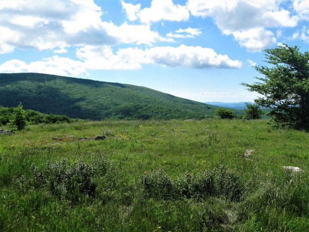 HIGHLIGHTS
 hostels (I-81 pretty much parallels the trail making hopping in and out of towns easy), reasonable shelter distances (except for one section: Chatfield to Knot Maul Branch shelters was 19+ miles) and decent camping spots to make planning fairly straight-forward. Furthermore, other than a few steep climbs, this section was more rolling than others (although I learned a new trail term thanks to a young lady from Alberta describing the trail in this, and other, area(s):
 PUDS – “pointless ups and downs”…a term we quickly adopted and frequently used during our outing). Here are a few specifics…
 Grayson Highlands/Mount Rogers National Recreation Area – Going trail-north from Elk Garden, you walk through the beautifully scenic, rocky, vista-filled area that is Mount Rogers National Recreation Area. The views from the ridge of the Balsam Mountains and
  Mount Rogers were spectacular! One of the items on our AT bucket list has always been to find the place with the “wild ponies,” icons on any AT info. Well, this is where they are…and we were not disappointed. According to the brochure from the park ranger, these little guys (some not so little) have been specifically bred for the harsh climate of the area to browse the harsh vegetation to keep the mountains and meadows
  here clear. It’s apparent they’re doing a fine job. The fact that they’re adorable is like the cherry on top of a the perfect sundae. We saw a number of herds from both near and far over the two days we traversed this area.
 chasing each other along an old logging road on the north side of Chestnut Knob…no sign of mamma. One lazy black snake, a coyote, a bunch of squirrels and about a billion chipmunks rounded out the list of wildlife…excluding the guy with the guitar singing crude songs at Saunders Shelter.
 from the time we’ve left Georgia…guessing “flora” may be more elevation-related than latitude-related (given the short actual distance we’ve traveled north). There was one section where primroses lined the trail…unexpectedly different. There were three obvious “new” trees in relative abundance here in southwest Virginia not found further south: witch hazel, striped maple and chestnut oak. Witch hazel has a number of legitimate medical uses as well as being THE tree branch to
  use as a divining rod. Chestnut oak acorns are supposed to be the sweetest tasting, if prepared correctly. And one brochure I found said the leaves of the striped maple resemble a duck’s foot.
 the “residents” were kept corralled by a number of different styles of stiles that we had to negotiate. They varied from 180 degree-turn, narrowing fences to ladders-over-barbed wire to plain old gates. The
  cattle’s attitude varied, too, from annoyed at our passing to a passively-belligerent young bull. As an aside, one of the guides I read suggested caution when crossing these fields, being on the lookout for meadow muffins, pasture pastries and, the more common, cow chips.
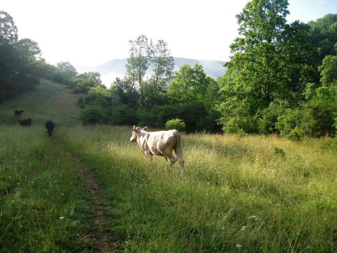
 Bridges – Of course there have been hundreds if not thousands of bridges crossing the countless streams so far along the AT, but the number of different types and, for some, the simple elegance of their construction struck a chord with me this time out. Could have been the trail monotony I mentioned above…

 hikers: the youngest, a 17 year old guy from Missouri (“Lonesome”) looking to complete the trail before school starts in September…the oldest, an 80-something lady (“Broken Arrow”) originally from Long Island who said she
  has dreamed of doing this for 30 years. They came from all over the USA as well as several from Germany, Finland, the UK and New Zealand. Most all were traveling by themselves (“hiking your own hike” is a “thing” on the AT) but ended up reuniting with the same hikers in the evenings. There was a great deal of palpable camaraderie as they talked and joked with each other
  during the one day we were all stuck together in a shelter due to a pounding, unceasing rain storm. The next morning, in the predawn as I was searching for my headlamp, several packed up and stepped off with only a good morning/good-by nod. They all were focused and determined and most were racking up huge daily distances: 20 to 30 miles a day. Best of luck and God-speed to them all!
 Section Hikers – Finally, there were quite a few section hikers, like us, out for just a few
  days to a few weeks. Most were older (not quite as old as us, but not 20-year-olds either) and were with their spouse or friends…more women out hiking together than men. The award for being the “best dad in the world” went to a local guy taking three days walking with his three kids: 10, 7 and 6 years old. The guy was carrying a 80-liter pack (best guess 60 pounds) full of food, tent and miscellaneous supplies; the kids carried their own
 clothes and sleeping bags. It was obvious they were having the time of their lives. They stopped at our shelter for a break (pop tarts!) but moved on because, as the father said, the “kids can get a bit fussy.” We passed their quiet camp a half mile up the trail early the next morning. Good memories in the making.
 Officially, we logged 105.6 miles on the AT this time, plus a few more miles as a result of side trails to shelters and to fetch water. Somewhere we passed the “quarter way to Maine” sign but we all missed it. With 574 miles under our belt, that leaves only 1606 to reach Katahdin! Happy Trails!
 It’s been a year since Bob and I last set foot on the Appalachian Trail to move our section progress northward. Ever since completing the Smokies, we had set our sight on Damascus, VA as our next milestone…and cause for celebration. While we had initially
  planned to accomplish this 96 mile section in one two-week trip, a severe case of blisters on the ball of my left foot caused us to leave the trail after only walking 21 miles. A month…and a new pair of boots…later, we completed the trek in nine days, celebrating, with restraint, at Chick-fil-A (as we still had a six-hour drive to get back home).
 trip started in July and the final segment in late August. While July was uncharacteristically cool (high’s in the upper 70’s/low 80’s) and humid, late August was stinking hot (90’s) with stifling humidity. We were sweat-soaked the entire August trip. Nothing would ever dry no matter how long our clothes hung in the languid breeze. So choose your timing with care!
 Roan Highlands (from Hughes Gap to Watauga Lake). However, once we climbed to the ridge over Watauga Lake, there were no creeks or mountainside seeps or springs. Water sources for two shelters (Vandeventer and Abingdon Gap) were WAAAAAY down into adjoining valleys, about a half mile from the shelters. Read your guides and then review the logs at each shelter and talk with hikers you pass along the trail to get updated info as to how hard (or if) the springs are flowing and adjust your plans accordingly.
 also currently closed due to fallen trees from the July tornado. Which means the distance from the last viable shelter (Moreland Gap) to the next (Vandeventer) in this area is 23.5 miles, making a stop at hostels at Dennis Cove Road, Kincora (

 Mountain were deep, dark and hushed. The views from the balds (Round, Jane, Grassy Ridge, Little Hump, Hump) to the north were breathtaking on one day and frightfully spooky the next when everything was shrouded in clouds, fog and rain. There were a lot of folks at Roan Mountain on the weekend we were there, but the crowds cleared out almost entirely on the weekdays.

 were scarce and, given the number of side and “social trails,” it was relatively easy to get turned around if you don’t pay close attention.

 most of this segment was a continuation of the “Long Green Tunnel” that is the AT. Maybe because of that, I really appreciated any break in the trees, especially along the ridge above Watauga Lake, which revealed wonderful views of the lake, valley and row upon row of ridges to the horizon. The Vandeventer Shelter, in particular, had excellent views of the northeastern end of the lake.
 summer, there were blooming flowers, end of the season blackberries and early apples…the leaves on more than a few trees were turning their autumnal tinge. We also saw deer, chipmunks, squirrels, a turtle and snakes (black and rattle) and plenty of signs of bears (scat and torn apart rotting tree trunks) but no bears themselves…which was OK. We did pay particular
  attention to hanging our food and any smell-ables high and away each and every night. There were a few mice in a couple of shelters, but they were no bother to us or our food or packs…but again, we kept an immaculate cooking/eating area and hung anything that they might have been interested in. Also note that we wore long pants the entire trip to defend against ticks hunkering on encroaching weeds…we escaped tick-free!
 The Hostels: we took the occasion to over-night at Mountain Harbour (
 both had serious collections of old DVD’s. It was kind of weird that we watched “Young Frankenstein” not knowing that Gene Wilder had died earlier that same day. A special note: for $12, Mountain Harbour has a huge and crazy good breakfast feast available if there are enough people in residence…don’t miss it!
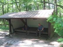 which way the trail goes. Similarly, the weeds appeared to be newly trimmed back along our entire segment until we got north of Low Gap (US421, Shady Valley, TN). And finally, the “renovated” shelter at Abingdon Gap looks fantastic…here’s hoping the graffiti artists can control their creativity to the provided board. Thanks, TEHC!
 And so we entered sunny, hot Damascus, VA, quietly at mid-day, at mid-week. We took the requisite pictures at the welcome sign and then dropped our packs in the truck before heading to Chick-fil-A on our way back to Georgia. Officially, we’ve travelled 468.5 miles on the trail, leaving (ignoring reroutings that will occur in the future) only 1,720.6 miles to Katahdin. But next, we need to get to Harpers Ferry, WV…just 550 miles away!